| P number: | P000605 |
|---|---|
| Old photograph number: | D01517 |
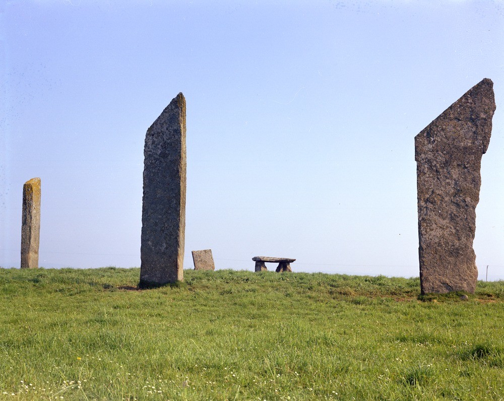
| Caption: | Standing Stones of Stenness, south-east end of Loch of Stenness. Orkney. The henge and stone circle have radiocarbon dates suggesting that Stenness was constructed during the 3rd. millennium B.C. |
| Description: | Standing Stones of Stenness, south-east end of Loch of Stenness. Orkney. The henge and stone circle have radiocarbon dates suggesting that Stenness was constructed during the 3rd. millennium B.C. Four thin, unshaped flagstones now survive, the tallest over five metres high; it is thought that there were originally twelve stones set in a circle about 30 metres in diameter. Ploughing has almost levelled the henge earthworks but the circle once stood within a ditch and bank, with an entrance causeway to the north. The henge and stone circle of Stenness together with the Ring of Brodgar and associated outlying stones and burial mounds form part of a great ceremonial complex in the heart of Orkney, comparable to Callanish on Lewis in the Western Isles and to Stonehenge on Salisbury Plain in Wiltshire. |
| Date taken: | Tue Jan 01 00:00:00 GMT 1974 |
| Photographer: | Christie, A. |
| Copyright statement: | NERC |
| Acknowledgment: | This image was digitized with grant-in-aid from SCRAN the Scottish Cultural Resources Access Network |
| X longitude/easting: | 330600 |
| Y latitude/northing: | 1012700 |
| Coordinate reference system, ESPG code: | 27700 (OSGB 1936 / British National Grid) |
| Orientation: | Landscape |
| Size: | 253.71 KB; 1000 x 796 pixels; 85 x 67 mm (print at 300 DPI); 265 x 211 mm (screen at 96 DPI); |
| Average Rating: | Not yet rated |
| Categories: | Unsorted Images, Geoscience subjects/ Archaeology and early history |
Loading...
Loading...
Reviews
There is currently no feedback