| P number: | P210469 |
|---|---|
| Old photograph number: | A10570 |
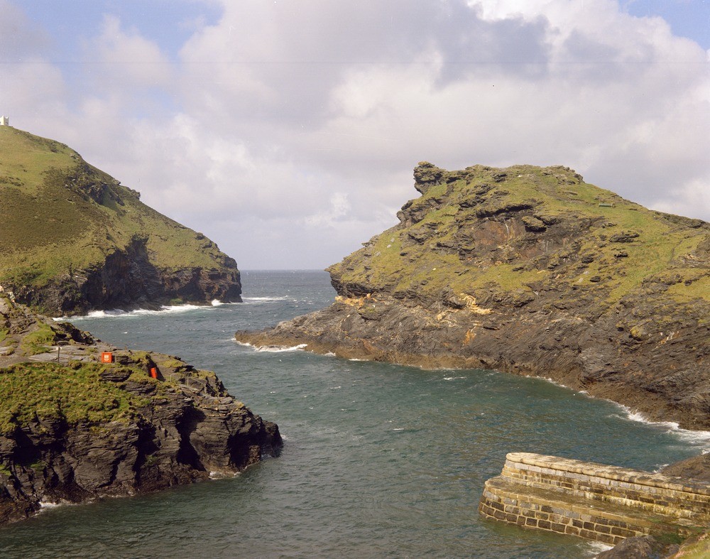
| Caption: | View from opposite the quay at Boscastle Harbour. Looking WSW. |
| Description: | View from opposite the quay at Boscastle Harbour. Looking WSW. Boscastle Harbour. Boscastle Harbour is situated in the drowned mouth of the River Valeney. All the rocks in the photograph are black slates, siltstones and occasional sandstones of the Crackington Formation. The masses of quartz which can be seen have been affected by the late ruck folding. |
| Date taken: | Sat Jan 01 00:00:00 GMT 1966 |
| Photographer: | Pulsford, J.M. |
| Copyright statement: | NERC |
| X longitude/easting: | 209500 |
| Y latitude/northing: | 91500 |
| Coordinate reference system, ESPG code: | 27700 (OSGB 1936 / British National Grid) |
| Orientation: | Landscape |
| Size: | 270.16 KB; 1000 x 787 pixels; 85 x 67 mm (print at 300 DPI); 265 x 208 mm (screen at 96 DPI); |
| Average Rating: | Not yet rated |
| Categories: | Unsorted Images, Geoscience subjects/ Landforms, river/ Drowned valleys |
Loading...
Loading...
Reviews
There is currently no feedback