| P number: | P210433 |
|---|---|
| Old photograph number: | A10534 |
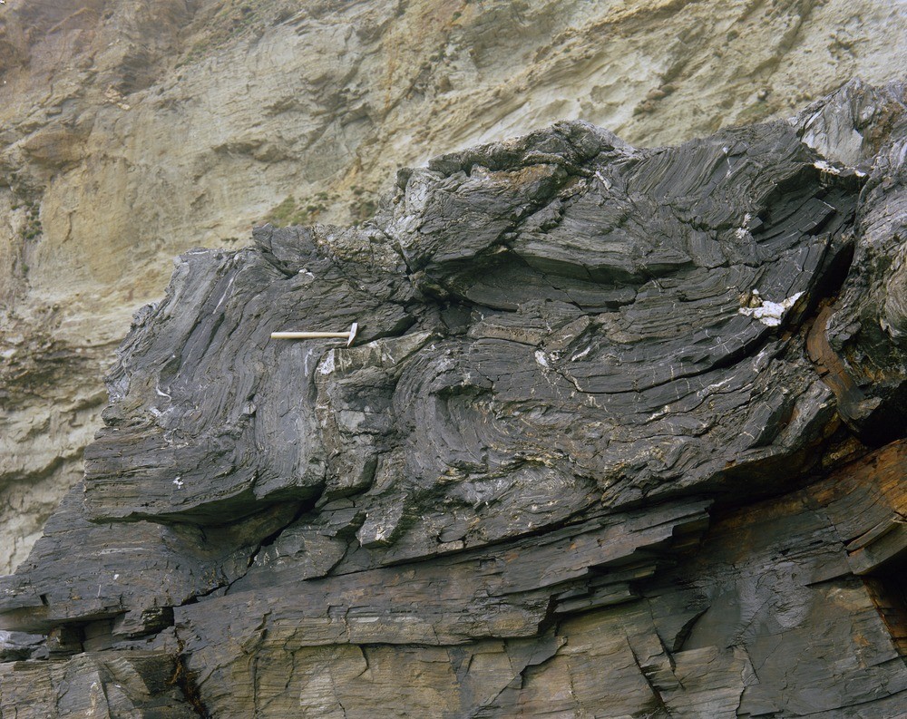
| Caption: | 10 ft above high water mark on SE side of Hole Beach, Trebarwith Strand. Looking NE. |
| Description: | 10 ft above high water mark on SE side of Hole Beach, Trebarwith Strand. Looking NE. Crumpled and drag folding occurs along a low-angle normal fault in slates and sandstones (at hammer head) of the Trambley Cove Formation. The fault plane occurs immediately below the folding. |
| Date taken: | Sat Jan 01 00:00:00 GMT 1966 |
| Photographer: | Pulsford, J.M. |
| Copyright statement: | NERC |
| X longitude/easting: | 205500 |
| Y latitude/northing: | 87500 |
| Coordinate reference system, ESPG code: | 27700 (OSGB 1936 / British National Grid) |
| Orientation: | Landscape |
| Size: | 348.36 KB; 1000 x 793 pixels; 85 x 67 mm (print at 300 DPI); 265 x 210 mm (screen at 96 DPI); |
| Average Rating: | Not yet rated |
| Categories: | Unsorted Images, Geoscience subjects/ Structural features/ Fault breccia, Geoscience subjects/ Structural features/ Folding |
Loading...
Loading...
Reviews
There is currently no feedback