| P number: | P000598 |
|---|---|
| Old photograph number: | D01496 |
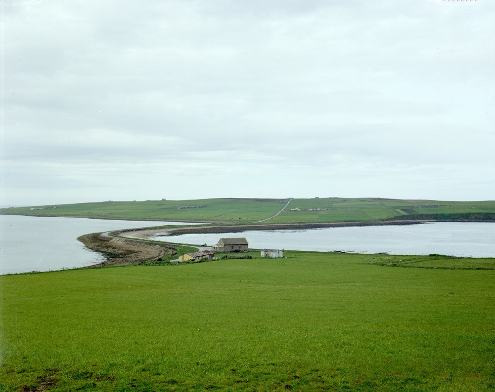
| Caption: | The Ayre, linking Hoy to South Walls and separating North Bay (Longhope) (left) from Aith Hope (right). A typical 'ayre' (tombolo) linking two islands. |
| Description: | The Ayre, linking Hoy to South Walls and separating North Bay (Longhope) (left) from Aith Hope (right). A typical 'ayre' (tombolo) linking two islands. A narrow crescentic mound of shingle that was breached until the road was built. An examination of Admiralty Charts for the Orkneys shows that ayres tend to be formed by the transport of materials by eddy currents set up in bays by the flood tide. |
| Date taken: | Wed Jan 01 00:00:00 GMT 1975 |
| Photographer: | Christie, A. |
| Copyright statement: | NERC |
| Acknowledgment: | This image was digitized with grant-in-aid from SCRAN the Scottish Cultural Resources Access Network |
| X longitude/easting: | 328500 |
| Y latitude/northing: | 989500 |
| Coordinate reference system, ESPG code: | 27700 (OSGB 1936 / British National Grid) |
| Orientation: | Landscape |
| Size: | 161.34 KB; 1001 x 794 pixels; 85 x 67 mm (print at 300 DPI); 265 x 210 mm (screen at 96 DPI); |
| Average Rating: | Not yet rated |
| Categories: | Unsorted Images, Geoscience subjects/ Landforms, marine/ Coastal deposition, sand-bars, shingle-ridges, storm-beaches |
Loading...
Loading...
Reviews
There is currently no feedback