| P number: | P000595 |
|---|---|
| Old photograph number: | D01491 |
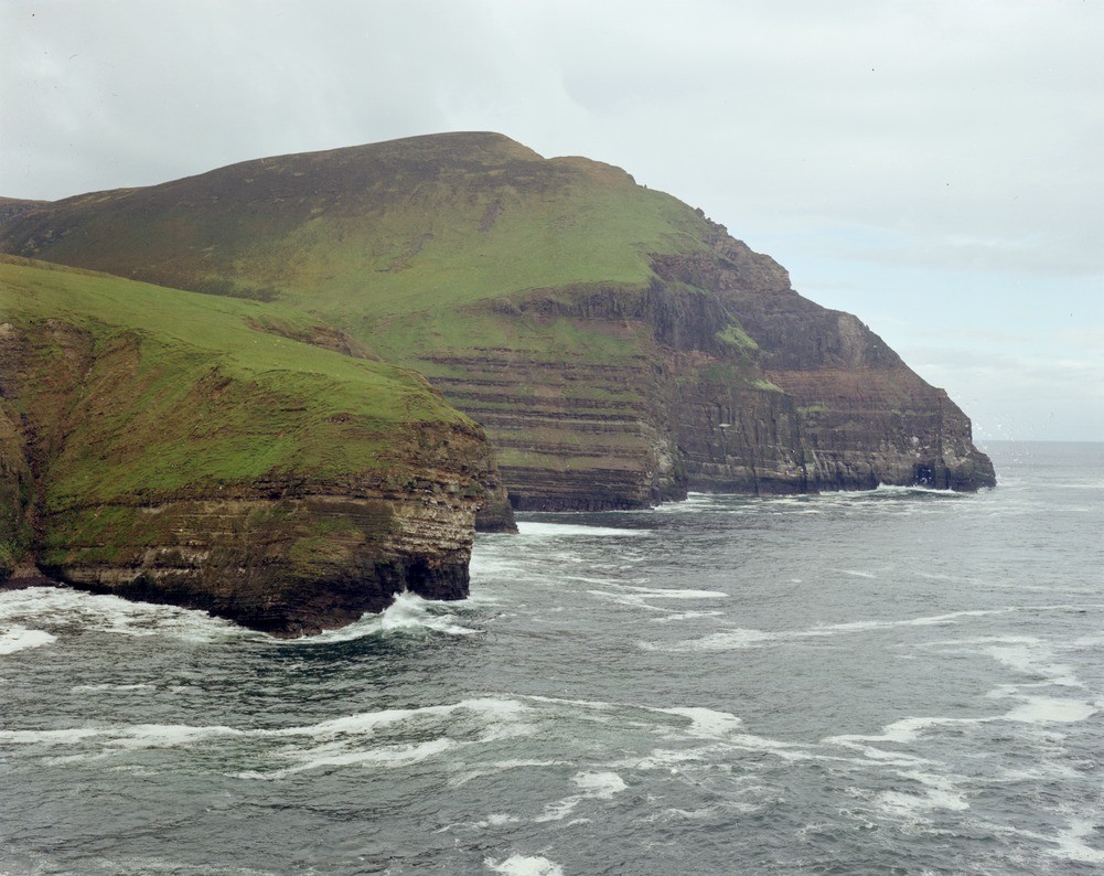
| Caption: | Kame of Hoy, Orkney, looking west from the east shore of the Bay of the Tongue. |
| Description: | The Hoy lavas have been dated at c. 353 million years, which is Upper Devonian. Minor igneous intrusions on Orkney consist of over 200 dykes and a small number of sills. The bostonite sill is formed of almost pure feldspar rock with some chlorite and carbonate. Cliff section showing (top to bottom), Hoy Sandstone, columnar basalt lava, basic tuffs, Upper Stromness Flags and (at base of cliff in middle distance) sill of bostonite. |
| Date taken: | Tue Jan 01 00:00:00 GMT 1974 |
| Photographer: | Christie, A. |
| Copyright statement: | NERC |
| Acknowledgment: | This image was digitized with grant-in-aid from SCRAN the Scottish Cultural Resources Access Network |
| X longitude/easting: | 320800 |
| Y latitude/northing: | 1004900 |
| Coordinate reference system, ESPG code: | 27700 (OSGB 1936 / British National Grid) |
| Orientation: | Landscape |
| Size: | 223.55 KB; 1001 x 794 pixels; 85 x 67 mm (print at 300 DPI); 265 x 210 mm (screen at 96 DPI); |
| Average Rating: | Not yet rated |
| Categories: | Unsorted Images |
Loading...
Loading...
Reviews
There is currently no feedback