| P number: | P210341 |
|---|---|
| Old photograph number: | A10442 |
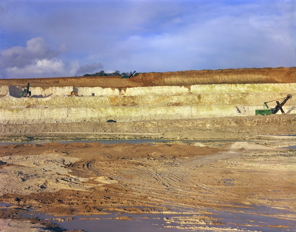
| Caption: | N. face of Wouldham's Chalk Pit at Grays Thurrock. Looking N. |
| Description: | N. face of Wouldham's Chalk Pit at Grays Thurrock. Looking N. Gravel of Boyn Hill Terrace (darker bed at top of section) overlying Thanet Sand, in turn overlying Upper Chalk. Thanet Sand locally piped into Chalk. |
| Date taken: | Sat Oct 01 00:00:00 BST 1966 |
| Photographer: | Friend, C.A.F. |
| Copyright statement: | NERC |
| X longitude/easting: | 560500 |
| Y latitude/northing: | 179500 |
| Coordinate reference system, ESPG code: | 27700 (OSGB 1936 / British National Grid) |
| Orientation: | Landscape |
| Size: | 311.65 KB; 1000 x 786 pixels; 85 x 67 mm (print at 300 DPI); 265 x 208 mm (screen at 96 DPI); |
| Average Rating: | Not yet rated |
| Categories: | Unsorted Images, Geoscience subjects/ Economic geology/ Cement and lime, limestone quarries and chalk pits |
Loading...
Loading...
Reviews
There is currently no feedback