| P number: | P000590 |
|---|---|
| Old photograph number: | D01486 |
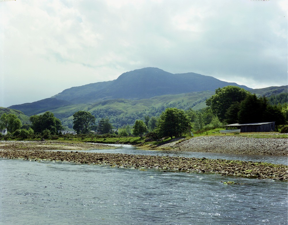
| Caption: | Beinn a' Chapuill, 4.0 km. south-south-east of Glenelg. The upper part of the mountains is formed of siliceous schist of the Moine series, and the lower part is Lewisian gneiss. |
| Description: | Beinn a' Chapuill, 4.0 km. south-south-east of Glenelg. The upper part of the mountains is formed of siliceous schist of the Moine series, and the lower part is Lewisian gneiss. The rocks in this area are part of the Moine Nappe, highly folded Lewisian and Moine rocks that have been moved along the Moine Thrust, the most easterly of the major thrust planes of the Caledonian Thrust Zone. The Lewisian is thought to occur as either the core of tight anticlinal folds or as thrust slices. |
| Date taken: | Wed Jan 01 00:00:00 GMT 1975 |
| Photographer: | Christie, A. |
| Copyright statement: | NERC |
| Acknowledgment: | This image was digitized with grant-in-aid from SCRAN the Scottish Cultural Resources Access Network |
| X longitude/easting: | 180500 |
| Y latitude/northing: | 818200 |
| Coordinate reference system, ESPG code: | 27700 (OSGB 1936 / British National Grid) |
| Orientation: | Landscape |
| Size: | 239.67 KB; 1000 x 780 pixels; 85 x 66 mm (print at 300 DPI); 265 x 206 mm (screen at 96 DPI); |
| Average Rating: | Not yet rated |
| Categories: | Unsorted Images |
Loading...
Loading...
Reviews
There is currently no feedback