| P number: | P000589 |
|---|---|
| Old photograph number: | D01485 |
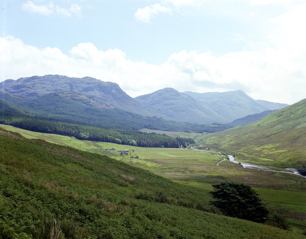
| Caption: | View looking east-south-east up the Glenmore River, from near Achadhachuirn about 6.4 km. east-south-east of Glenelg. |
| Description: | With the cessation of the Caledonian folding there followed in the Old Red Sandstone times (about 370-400 Ma. ago) the intrusion of large igneous masses. The Glenelg-Ratagain complex is one such body. It consists of successive intrusions of granitic and dioritic rocks with basic and ultrabasic rocks. The lower smooth slopes are composed of diorite, etc. of the Glenelg-Ratagain complex. The mountains against the sky are chiefly composed of Moine schist. |
| Date taken: | Wed Jan 01 00:00:00 GMT 1975 |
| Photographer: | Christie, A. |
| Copyright statement: | NERC |
| Acknowledgment: | This image was digitized with grant-in-aid from SCRAN the Scottish Cultural Resources Access Network |
| X longitude/easting: | 185700 |
| Y latitude/northing: | 820300 |
| Coordinate reference system, ESPG code: | 27700 (OSGB 1936 / British National Grid) |
| Orientation: | Landscape |
| Size: | 208.55 KB; 1000 x 780 pixels; 85 x 66 mm (print at 300 DPI); 265 x 206 mm (screen at 96 DPI); |
| Average Rating: | Not yet rated |
| Categories: | Unsorted Images |
Loading...
Loading...
Reviews
There is currently no feedback