| P number: | P210227 |
|---|---|
| Old photograph number: | A10326 |
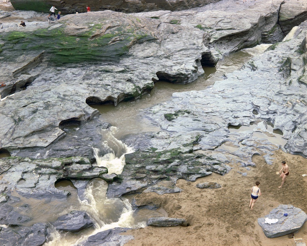
| Caption: | The foreshore at Trebarwith Strand. Looking E. |
| Description: | The foreshore at Trebarwith Strand. Looking E. A channel and potholes formed in calcareous volcanic rocks from Lower Culm Measures by a freshwater stream. |
| Date taken: | Fri Jan 01 00:00:00 GMT 1965 |
| Photographer: | Pulsford, J.M. |
| Copyright statement: | NERC |
| X longitude/easting: | 204500 |
| Y latitude/northing: | 86500 |
| Coordinate reference system, ESPG code: | 27700 (OSGB 1936 / British National Grid) |
| Orientation: | Landscape |
| Size: | 605.75 KB; 1000 x 802 pixels; 85 x 68 mm (print at 300 DPI); 265 x 212 mm (screen at 96 DPI); |
| Average Rating: | Not yet rated |
| Categories: | Unsorted Images, Geoscience subjects/ Landforms, river/ Waterfalls and pot-holes |
Loading...
Loading...
Reviews
There is currently no feedback