| P number: | P000578 |
|---|---|
| Old photograph number: | D00773 |
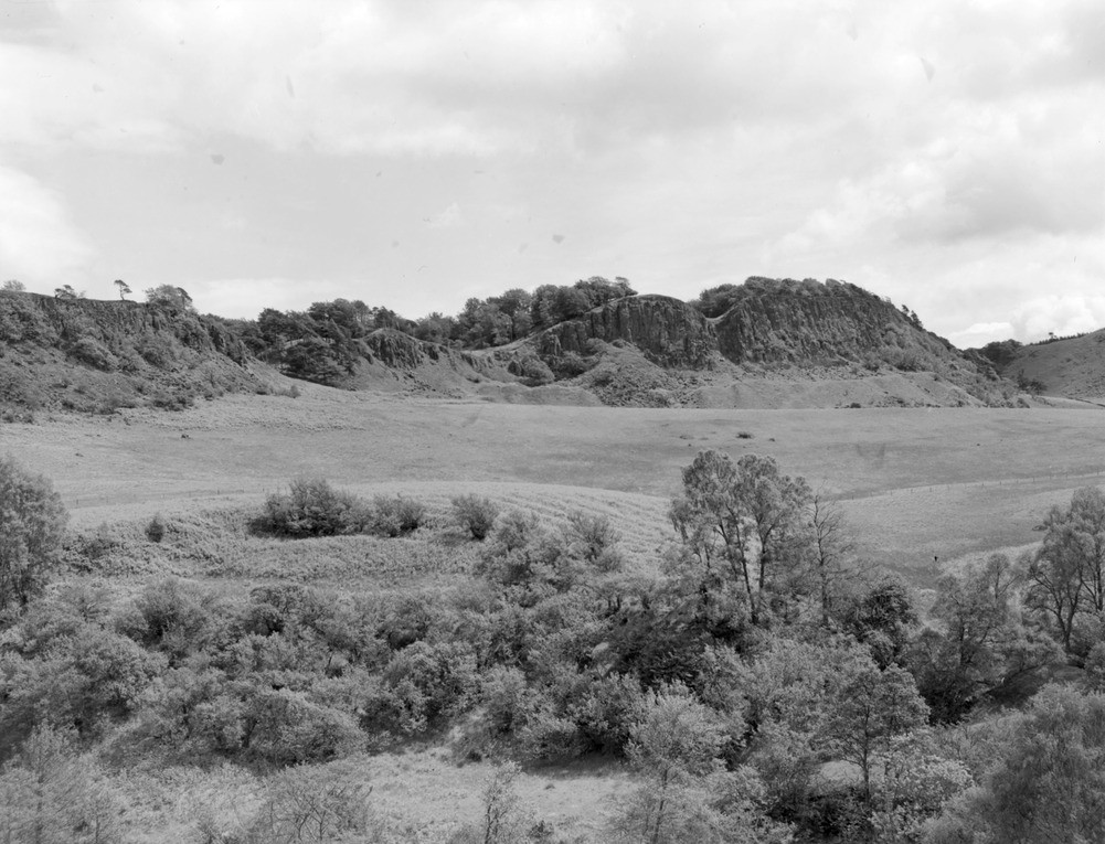
| Caption: | Looking eastwards across the Bannock Burn, north of North Third Reservoir towards the escarpment of the Stirling quartz-dolerite sill at Sauchie Craigs. |
| Description: | Looking eastwards across the Bannock Burn, north of North Third Reservoir towards the escarpment of the Stirling quartz-dolerite sill at Sauchie Craigs. The sill is intruded into sediments in the lower part of the Carboniferous Lower Limestone Group. A line of tips marks old opencast workings in the Murrayshall (Hurlet) Limestone at the base of the Group. A series of gullies which interrupt the escarpment mark lines of highly decomposed dolerite along major joints. The outcrop here is one of of several striking westward-facing crags which extend south from Abbey Craig and Stirling Castle along the western limb of the Clackmannan Syncline, a major structural feature of the area. |
| Date taken: | Mon Jan 01 00:00:00 GMT 1962 |
| Photographer: | Fisher, W.D. |
| Copyright statement: | Crown |
| Acknowledgment: | This image was digitized with grant-in-aid from SCRAN the Scottish Cultural Resources Access Network |
| X longitude/easting: | 276500 |
| Y latitude/northing: | 690500 |
| Coordinate reference system, ESPG code: | 27700 (OSGB 1936 / British National Grid) |
| Orientation: | Landscape |
| Size: | 206.86 KB; 1001 x 765 pixels; 85 x 65 mm (print at 300 DPI); 265 x 202 mm (screen at 96 DPI); |
| Average Rating: | Not yet rated |
| Categories: | Unsorted Images |
Loading...
Loading...
Reviews
There is currently no feedback