| P number: | P000574 |
|---|---|
| Old photograph number: | D00769 |
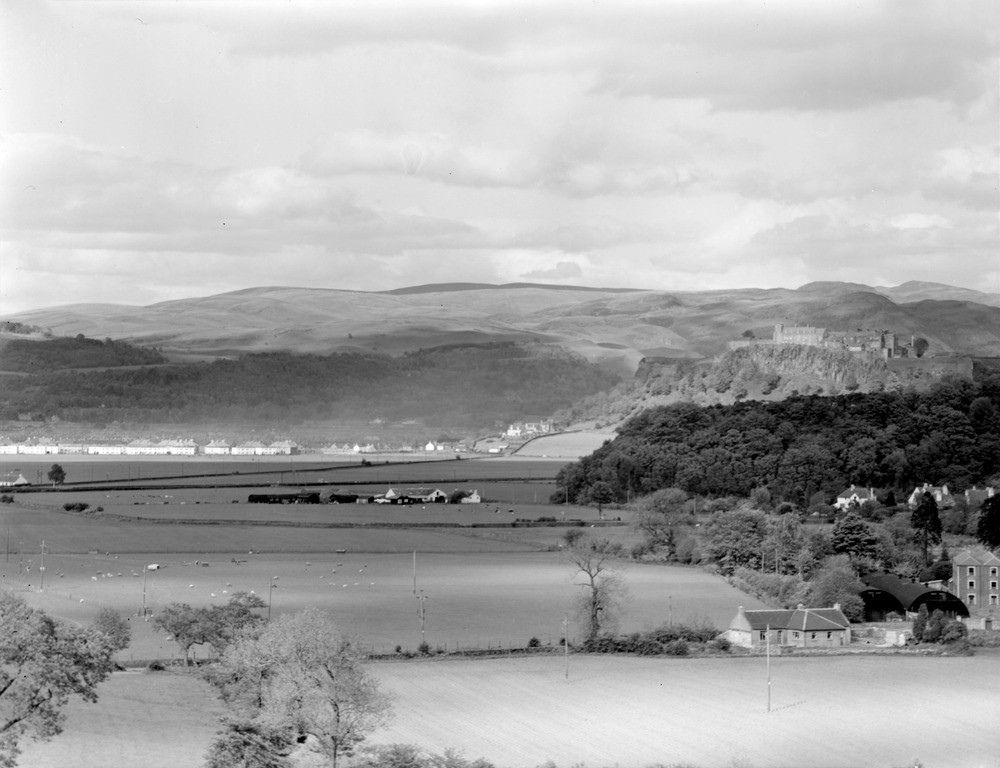
| Caption: | Stirling Castle Rock from the south-south-west. The photograph shows the quartz-dolerite sill rising from the flat carseland, to the left and with the Ochil Hills in the background. |
| Description: | Stirling Castle Rock from the south-south-west. The photograph shows the quartz-dolerite sill rising from the flat carseland, to the left and with the Ochil Hills in the background. The Stirling sill is known from borehole evidence to be about 300 ft. thick and is intruded into various horizons ranging from the top of the Calciferous Sandstone Measures to about the middle of the Limestone Coal Group (both Carboniferous). The outcrop here is one of of several striking westward-facing crags which extend south from Abbey Craig and Stirling Castle along the western limb of the Clackmannan Syncline, a major structural feature of the area. |
| Date taken: | Mon Jan 01 00:00:00 GMT 1962 |
| Photographer: | Fisher, W.D. |
| Copyright statement: | Crown |
| Acknowledgment: | This image was digitized with grant-in-aid from SCRAN the Scottish Cultural Resources Access Network |
| X longitude/easting: | 277500 |
| Y latitude/northing: | 692500 |
| Coordinate reference system, ESPG code: | 27700 (OSGB 1936 / British National Grid) |
| Orientation: | Landscape |
| Size: | 147.55 KB; 1000 x 768 pixels; 85 x 65 mm (print at 300 DPI); 265 x 203 mm (screen at 96 DPI); |
| Average Rating: | Not yet rated |
| Categories: | Unsorted Images |
Loading...
Loading...
Reviews
There is currently no feedback