| P number: | P000569 |
|---|---|
| Old photograph number: | D00620 |
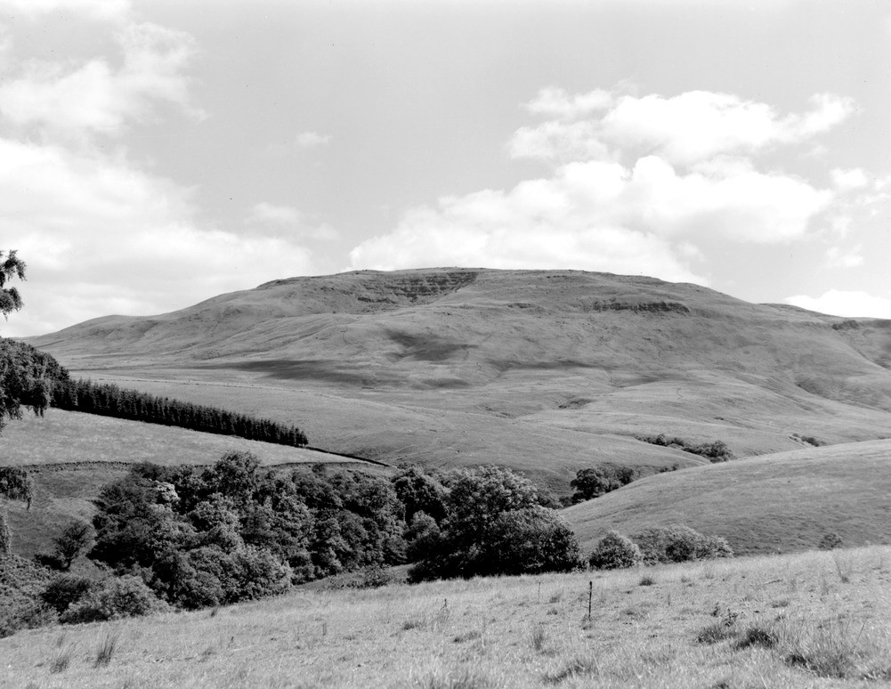
| Caption: | Arkleton Hill from the west-south-west. The lower part of the scarp in the right half of the photograph is formed by Upper Old Red Sandstone sediments while the Birrenswark Lavas form a line of crags which can be traced along this part of the scarp. |
| Description: | Arkleton Hill from the west-south-west. The lower part of the scarp in the right half of the photograph is formed by Upper Old Red Sandstone sediments while the Birrenswark Lavas form a line of crags which can be traced along this part of the scarp. The country from the foreground to the base of the scarp is underlain mainly by Silurian rocks. The upper part of the scarp here is composed of Whita Sandstone. Just below the skyline, left of centre, the Whita Sandstone crags in Black Cove can be seen. The base of the Birrenswark Lavas can be taken as the base of the Carboniferous. |
| Date taken: | Mon Jan 01 00:00:00 GMT 1962 |
| Photographer: | Fisher, W.D. |
| Copyright statement: | Crown |
| Acknowledgment: | This image was digitized with grant-in-aid from SCRAN the Scottish Cultural Resources Access Network |
| X longitude/easting: | 340500 |
| Y latitude/northing: | 592500 |
| Coordinate reference system, ESPG code: | 27700 (OSGB 1936 / British National Grid) |
| Orientation: | Landscape |
| Size: | 188.60 KB; 1001 x 774 pixels; 85 x 66 mm (print at 300 DPI); 265 x 205 mm (screen at 96 DPI); |
| Average Rating: | Not yet rated |
| Categories: | Unsorted Images |
Loading...
Loading...
Reviews
There is currently no feedback