| P number: | P210053 |
|---|---|
| Old photograph number: | A10148 |
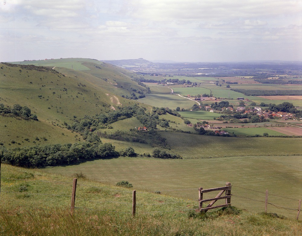
| Caption: | Devil's Dyke, near Brighton, Sussex. |
| Description: | Looking west to the Chalk escarpment of the South Downs from the Devil's Dyke, near Brighton. Middle Chalk occupies the steep face of the escarpment which is capped by Upper Chalk: the more gentle lower slopes (down to the road approximately) and the village of Fulking (middle distance) are underlain by Lower Chalk and by Gault and Upper Greensand respectively. The scarp face is dissected by numerous coombes, the simplest and most common types were formed by spring sapping and stream erosion probably during and immediately after glaciation when the normally porous Chalk was rendered impermeable by permafrost conditions. Chanctonbury Ring is visible in the far distance immediately behind the entrance to the Adur Gap. The striking escarpments of both the North and South Downs are similar in origin to the Lower Greensand escarpment. The comparatively hard Chalk is everywhere underlain by the soft Gault Clay. Sub-aerial denudation, having cut down to these beds, gradually undermines the harder beds and so produces a steep slope. |
| Date taken: | Wed Jan 01 00:00:00 GMT 1964 |
| Photographer: | Pulsford, J.M. |
| Copyright statement: | Crown |
| X longitude/easting: | 525500 |
| Y latitude/northing: | 110500 |
| Coordinate reference system, ESPG code: | 27700 (OSGB 1936 / British National Grid) |
| Orientation: | Landscape |
| Size: | 264.11 KB; 1000 x 781 pixels; 85 x 66 mm (print at 300 DPI); 265 x 207 mm (screen at 96 DPI); |
| Average Rating: | Not yet rated |
| Categories: | Unsorted Images, Geoscience subjects/ Landforms, river/ Escarpments, Geoscience subjects/ Stratigraphical/ Cretaceous |
Loading...
Loading...
Reviews
There is currently no feedback