| P number: | P210028 |
|---|---|
| Old photograph number: | A10123 |
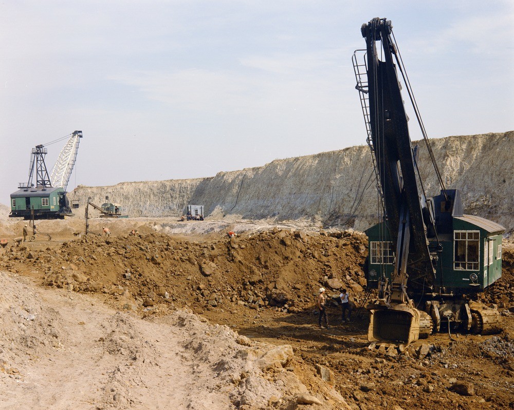
| Caption: | Rothwell Ironstone Pit, Stewarts and Lloyds, c. 1500 yd. E. of Hospital farm and 1 m. NW of Rothwell. Looking S. |
| Description: | Rothwell Ironstone Pit, Stewarts and Lloyds, c. 1500 yd. E. of Hospital farm and 1 m. NW of Rothwell. Looking S. 25 ft. of grey chalky boulder clay on 4 ft. Lower Estuarine Silts on 8 ft. of rubbly weathering Northampton Sand Ironstone. |
| Date taken: | Wed Jan 01 00:00:00 GMT 1964 |
| Photographer: | Pulsford, J.M. |
| Copyright statement: | Crown |
| X longitude/easting: | 479500 |
| Y latitude/northing: | 281500 |
| Coordinate reference system, ESPG code: | 27700 (OSGB 1936 / British National Grid) |
| Orientation: | Landscape |
| Size: | 307.51 KB; 1000 x 799 pixels; 85 x 68 mm (print at 300 DPI); 265 x 211 mm (screen at 96 DPI); |
| Average Rating: | Not yet rated |
| Categories: | Unsorted Images, Geoscience subjects/ Economic geology/ Metalliferous mining, ironstone, opencast |
Loading...
Loading...
Reviews
There is currently no feedback