| P number: | P209962 |
|---|---|
| Old photograph number: | A10056 |
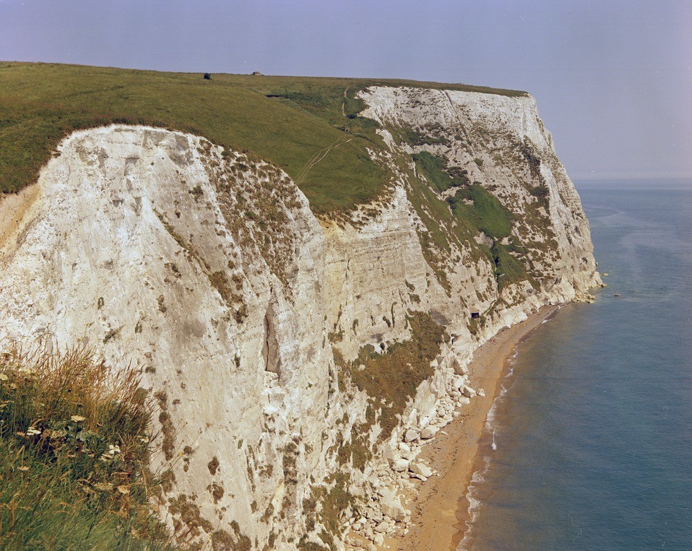
| Caption: | Langdon Bay, 1 1/2 m. E. of Dover. Looking ENE. |
| Description: | Langdon Bay, 1 1/2 m. E. of Dover. Looking ENE. Chalk cliffs at Langdon Bay. The chalk at the base of the cliffs is in the Terebratulina lata Zone, the Middle Chalk - Upper Chalk boundary being near the top of the pill-box at the bottom of the Langdon Stairs cliff-path. The chalk above represents the Upper Chalk zones of Holaster planus, Micraster cortestudinarium and Micraster coranguinum. |
| Date taken: | Tue Jan 01 00:00:00 GMT 1963 |
| Photographer: | Pulsford, J.M. |
| Copyright statement: | Crown |
| X longitude/easting: | 634500 |
| Y latitude/northing: | 142500 |
| Coordinate reference system, ESPG code: | 27700 (OSGB 1936 / British National Grid) |
| Orientation: | Landscape |
| Size: | 328.28 KB; 1000 x 796 pixels; 85 x 67 mm (print at 300 DPI); 265 x 211 mm (screen at 96 DPI); |
| Average Rating: | Not yet rated |
| Categories: | Unsorted Images, Geoscience subjects/ Landforms, marine/ Cliffs |
Loading...
Loading...
Reviews
There is currently no feedback