| P number: | P000552 |
|---|---|
| Old photograph number: | D00020 |
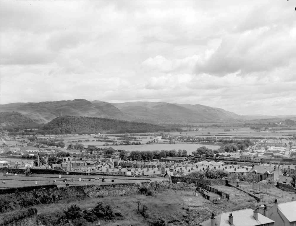
| Caption: | View from the Esplanade, Stirling Castle. |
| Description: | In the background lies the wooded escarpment of Abbey Craig, formed by the northernmost part of the Stirling Sill. Behind this are the Ochil Hills formed by lavas, agglomerates and tuffs of Lower Old Red Sandstone age. The steep southern face of the hills is a fault line scarp running along the Ochil Fault. The foreground shows the dip-slope of the Stirling Sill crossed by the deep cleft of the Pass of Ballengeich, immediately below the camera. In the middle distance, the intricate meanders of the River Forth may be seen crossing the flat plain formed by the silts and clays of the low 25 ft. raised beach. |
| Date taken: | Sun Jan 01 00:00:00 GMT 1956 |
| Photographer: | Fisher, W.D. |
| Copyright statement: | Crown |
| Acknowledgment: | This image was digitized with grant-in-aid from SCRAN the Scottish Cultural Resources Access Network |
| X longitude/easting: | 278500 |
| Y latitude/northing: | 694500 |
| Coordinate reference system, ESPG code: | 27700 (OSGB 1936 / British National Grid) |
| Orientation: | Landscape |
| Size: | 181.05 KB; 1001 x 766 pixels; 85 x 65 mm (print at 300 DPI); 265 x 203 mm (screen at 96 DPI); |
| Average Rating: | Not yet rated |
| Categories: | Best of BGS Images/ Landscapes |
Loading...
Loading...
Reviews
There is currently no feedback