| P number: | P000548 |
|---|---|
| Old photograph number: | C04007 |
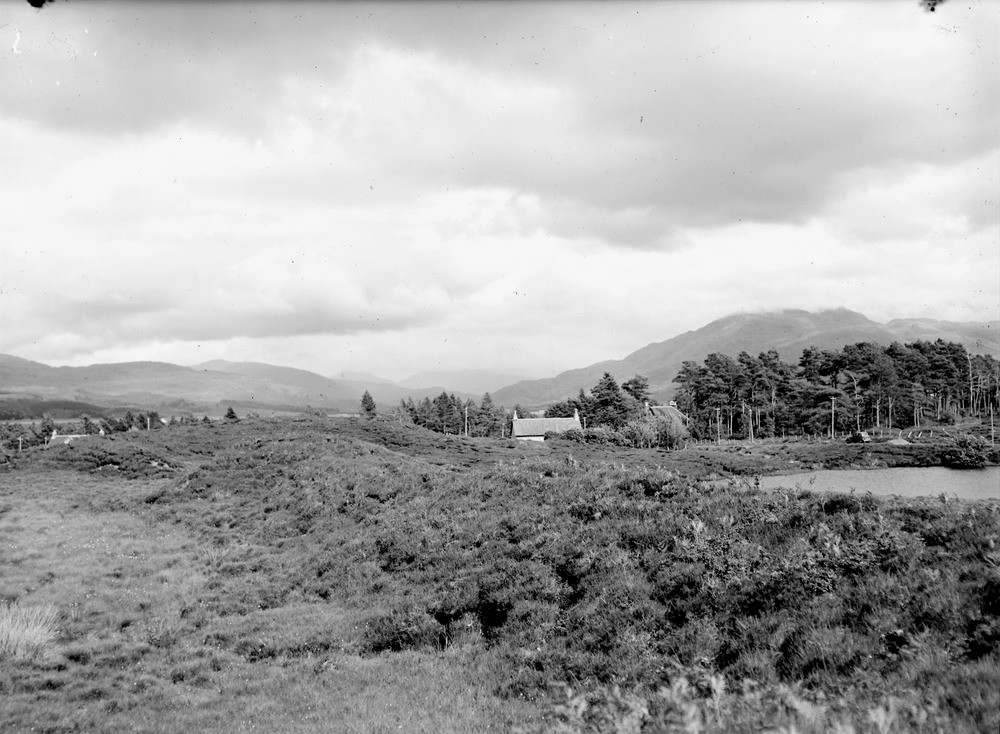
| Caption: | View at the north end of Acharacle Village, Loch Shiel. Looking east-south-east past Lochan a' Churraidh. A beaded sinuous esker extends eastwards (away from the observer). Lochan a' Churraidh (kettle-hole) on right. |
| Description: | View at the north end of Acharacle Village, Loch Shiel. Looking east-south-east past Lochan a' Churraidh. A beaded sinuous esker extends eastwards (away from the observer). Lochan a' Churraidh (kettle-hole) on right. The photograph is taken from the junction of the esker with an easterly-facing sand and gravel scarp (ice-contact slope) marking the eastward end of the Loch Shiel valley glacier and the landward edge of the Kentra outwash fan. Distant view is up Loch Shiel; Beinn Resipol cloud-capped is on the right. |
| Date taken: | Sat Jan 01 00:00:00 GMT 1949 |
| Photographer: | Fisher, W.D. |
| Copyright statement: | Crown |
| Acknowledgment: | This image was digitized with grant-in-aid from SCRAN the Scottish Cultural Resources Access Network |
| X longitude/easting: | 167500 |
| Y latitude/northing: | 768500 |
| Coordinate reference system, ESPG code: | 27700 (OSGB 1936 / British National Grid) |
| Orientation: | Landscape |
| Size: | 195.92 KB; 1000 x 734 pixels; 85 x 62 mm (print at 300 DPI); 265 x 194 mm (screen at 96 DPI); |
| Average Rating: | Not yet rated |
| Categories: | Unsorted Images |
Loading...
Loading...
Reviews
There is currently no feedback