| P number: | P209862 |
|---|---|
| Old photograph number: | A09955 |
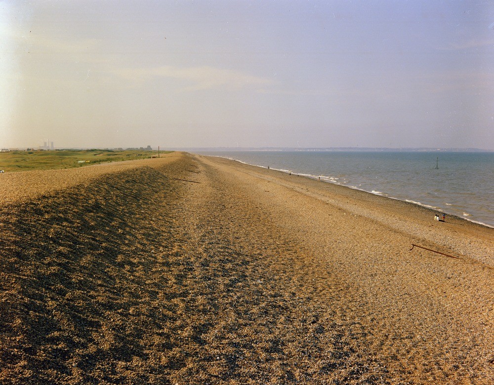
| Caption: | Sandwich Bay, about 100 yd. N. of Sandown Castle, Deal. Looking N. 20 degrees W. |
| Description: | Sandwich Bay, about 100 yd. N. of Sandown Castle, Deal. Looking N. 20 degrees W. Shingle beach ridge. A view showing the form of the shingle ridge built up by longshore drift, which now forms the coastline of Sandwich Bay, protecting the alluvial marshland of the Lydden Valley from inundation. The shingle is fairly coarse at this point. The transient storm beaches piled up by recent high seas can be clearly seen on the seaward side. |
| Date taken: | Tue Jan 01 00:00:00 GMT 1963 |
| Photographer: | Pulsford, J.M. |
| Copyright statement: | Crown |
| X longitude/easting: | 637500 |
| Y latitude/northing: | 154500 |
| Coordinate reference system, ESPG code: | 27700 (OSGB 1936 / British National Grid) |
| Orientation: | Landscape |
| Size: | 343.74 KB; 1000 x 780 pixels; 85 x 66 mm (print at 300 DPI); 265 x 206 mm (screen at 96 DPI); |
| Average Rating: | Not yet rated |
| Categories: | Unsorted Images, Geoscience subjects/ Landforms, marine/ Coastal deposition, sand-bars, shingle-ridges, storm-beaches |
Loading...
Loading...
Reviews
There is currently no feedback