| P number: | P209857 |
|---|---|
| Old photograph number: | A09950 |
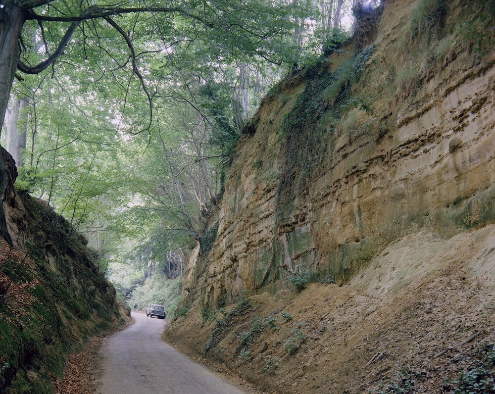
| Caption: | Sunken lane, road from Thorncombe Street leading to Godalming via Munstead Heath, Surrey. |
| Description: | Looking north-west at the road from Thorncombe Street (2 m. south-east of Godalming) leading to Godalming via Munstead Heath. A sunken lane in Hythe Beds. A section in 15 to 20 ft. of evenly-bedded loamy sand, containing seams of siliceous sandstone up to 3 inches thick. This road-cutting results from the wear caused by wheeled and hoofed transport over the years (before the road was metalled) and the removal of the sandy debris by rainwash and wind etc. on this sloping ground, which lies below the plateau formed by the Bargate Beds at the top of the hill beyond the car. The sunken roads of the Weald are a good example of man as a geological agent. Roads and farm tracks of this type are common over the whole of the Lower Greensand outcrop and in some localities on the outcrops of the Lower Tunbridge Wells Sand the Upper Greensand and the Chalk. All stages of their formation can be seen from simple tracks to cuttings 20 feet deep. |
| Date taken: | Tue Jan 01 00:00:00 GMT 1963 |
| Photographer: | Pulsford, J.M. |
| Copyright statement: | Crown |
| X longitude/easting: | 499500 |
| Y latitude/northing: | 142500 |
| Coordinate reference system, ESPG code: | 27700 (OSGB 1936 / British National Grid) |
| Orientation: | Landscape |
| Size: | 411.06 KB; 1000 x 796 pixels; 85 x 67 mm (print at 300 DPI); 265 x 211 mm (screen at 96 DPI); |
| Average Rating: | Not yet rated |
| Categories: | Best of BGS Images/ Geological structures, Geoscience subjects/ Archaeology and early history |
Loading...
Loading...
Reviews
There is currently no feedback