| P number: | P209852 |
|---|---|
| Old photograph number: | A09944 |
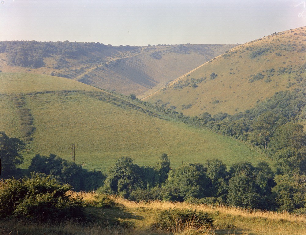
| Caption: | The Devil's Dyke, Saddlescombe - Poynings area, East Sussex, Sussex. |
| Description: | Looking south-west, a view of the Devil's Dyke from on the road between Saddlescombe and Poynings, East Sussex. The Devil's Dyke, a short, steep-sided, symmetrical dry valley in the Chalk of the South Downs, is cut in the crest of the Downs, and opens northwards into the low-lying country of the Low Weald. Early in its development the stream which eroded the valley probably flowed southward, down dip, in the col at left middle distance. Later headward erosion by a scarp-foot spring probably captured this stream, and initiated erosion which has resulted in the present form of the feature. Dry valleys are a characteristic feature of Chalk areas and may be a relic of a periglacial regime. Though found in areas of permeable bedrock which does not generally support a surface drainage system, the valleys were probably initiated by streams and rivers during periods when deep permafrost rendered the ground impermeable. |
| Date taken: | Tue Jan 01 00:00:00 GMT 1963 |
| Photographer: | Pulsford, J.M. |
| Copyright statement: | Crown |
| X longitude/easting: | 526500 |
| Y latitude/northing: | 111500 |
| Coordinate reference system, ESPG code: | 27700 (OSGB 1936 / British National Grid) |
| Orientation: | Landscape |
| Size: | 287.87 KB; 1000 x 770 pixels; 85 x 65 mm (print at 300 DPI); 265 x 204 mm (screen at 96 DPI); |
| Average Rating: | Not yet rated |
| Categories: | Unsorted Images, Geoscience subjects/ Landforms, river/ Dry valley |
Loading...
Loading...
Reviews
There is currently no feedback