| P number: | P209851 |
|---|---|
| Old photograph number: | A09943 |
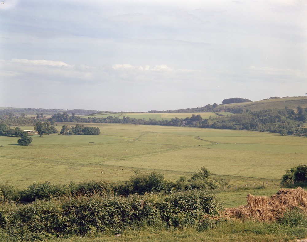
| Caption: | Arun flood plain at North Stoke, Sussex. |
| Description: | Looking south-south-east across the Arun flood plain at North Stoke. View from Houghton across the Arun Gap. This view is from an old chalk-pit cut in the river cliff at Houghton across the alluvial flat of the Arun towards the clump of trees known as Herons Wood. All the hills are in Upper Chalk. North Stoke Farm (at left) and the hamlet of South Stoke (beyond, at left) are both built on low promontories of Chalk veneered by river terrace gravels which provide dry sites between 10 and 15 feet above the half-mile-wide modern river alluvium. The Arun Gap has a great spread of alluvium bounded by steep river cliffs in its upper part. The Gault forms a 'V' downstream and a series of minor folds brings the Chalk to below river level one mile within the gap. As a result of this the Arun has cut sideways more rapidly where the softer beds are at stream level than where the hard Chalk forms the river bed and as a consequence the river has carved a wide, funnel-shaped entrance to the Arun Gap. |
| Date taken: | Tue Jan 01 00:00:00 GMT 1963 |
| Photographer: | Pulsford, J.M. |
| Copyright statement: | Crown |
| X longitude/easting: | 501500 |
| Y latitude/northing: | 110500 |
| Coordinate reference system, ESPG code: | 27700 (OSGB 1936 / British National Grid) |
| Orientation: | Landscape |
| Size: | 250.27 KB; 1000 x 790 pixels; 85 x 67 mm (print at 300 DPI); 265 x 209 mm (screen at 96 DPI); |
| Average Rating: | Not yet rated |
| Categories: | Unsorted Images, Geoscience subjects/ Landforms, river/ Flood-plains and alluvial flats |
Loading...
Loading...
Reviews
There is currently no feedback