| P number: | P209846 |
|---|---|
| Old photograph number: | A09938 |
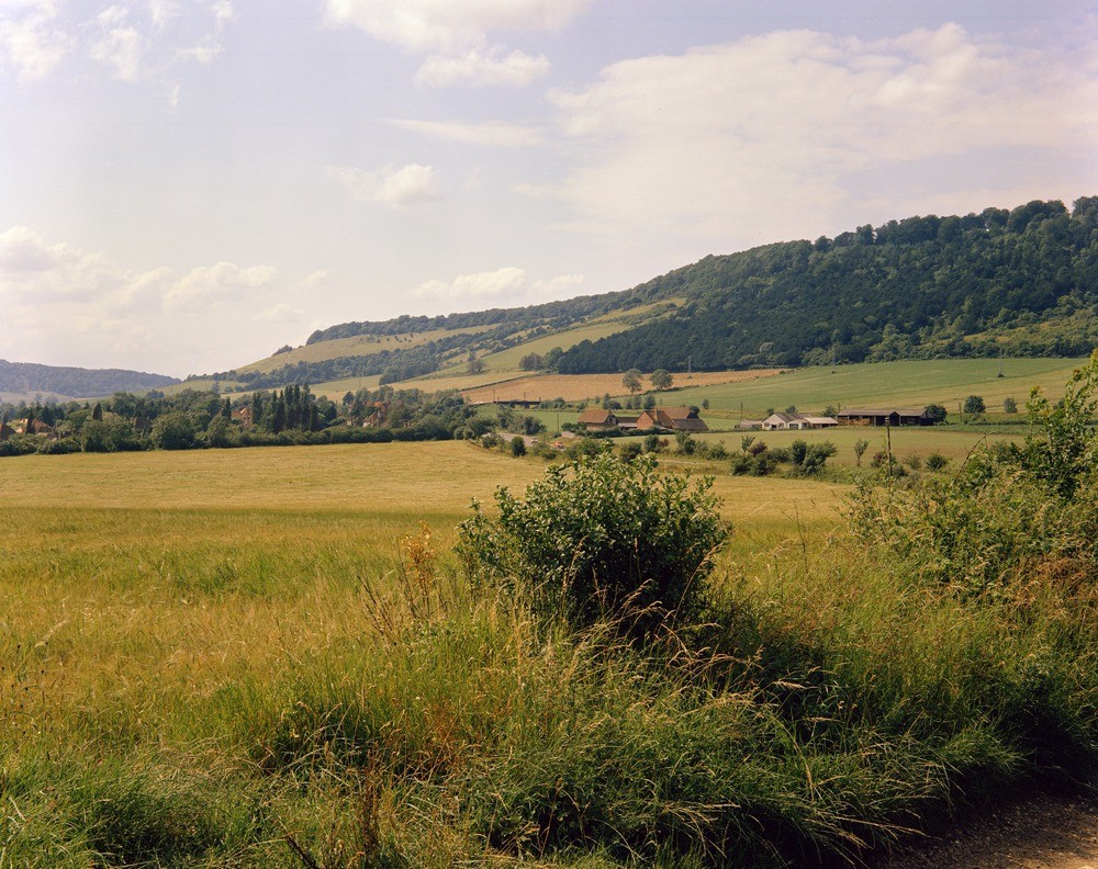
| Caption: | Box Hill, near Dorking. Looking WNW. |
| Description: | Box Hill, near Dorking. Looking WNW. Chalk escarpment of the North Downs. The vale beyond the main road is occupied by the Gault, the rising ground on the far side of the railway by Upper Greensand, and the steep slopes culminating in Box Hill on the left by Lower and Middle Chalk with a capping of Upper Chalk. To the left of the Mole Valley seen in the distance are the wooded slopes bordering Ranmore Common. |
| Date taken: | Tue Jan 01 00:00:00 GMT 1963 |
| Photographer: | Pulsford, J.M. |
| Copyright statement: | Crown |
| X longitude/easting: | 519500 |
| Y latitude/northing: | 151500 |
| Coordinate reference system, ESPG code: | 27700 (OSGB 1936 / British National Grid) |
| Orientation: | Landscape |
| Size: | 316.94 KB; 1000 x 792 pixels; 85 x 67 mm (print at 300 DPI); 265 x 210 mm (screen at 96 DPI); |
| Average Rating: | Not yet rated |
| Categories: | Unsorted Images, Geoscience subjects/ Landforms, river/ Escarpments |
Loading...
Loading...
Reviews
There is currently no feedback