| P number: | P209844 |
|---|---|
| Old photograph number: | A09936 |
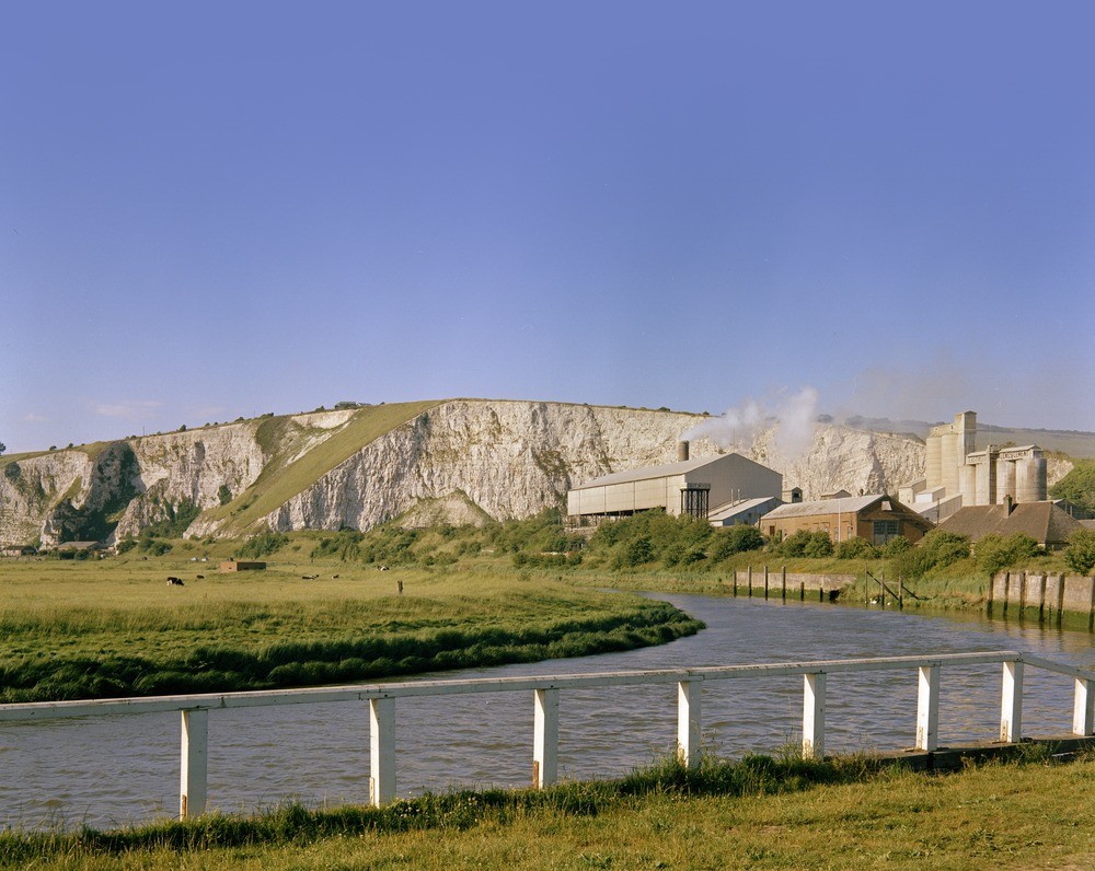
| Caption: | Cement works, Lewes, Sussex. |
| Description: | Looking north-east at Lewes, just south of Southerham Pit. Cement works utilizing the Chalk near Lewes. Snowdrop Pit (left) and Southerham Pit (both now disused) are in the Upper Chalk of a river-bluff of the Ouse. The axis of the Mount Caburn syncline runs between these quarries and opposing dips can just be made out at the ends of the exposed section. At this point the Ouse follows the eastern edge of its flood plain, which is seen in the foreground. The Middle Chalk passes beneath the flood plain at the bend in the river. Portland Cement was produced at Lewes cement works, Southerham, where marly Lower Chalk from two nearby pits was blended to provide feed for the kiln; no separate argillaceous material was added to the feed. |
| Date taken: | Tue Jan 01 00:00:00 GMT 1963 |
| Photographer: | Pulsford, J.M. |
| Copyright statement: | Crown |
| X longitude/easting: | 542500 |
| Y latitude/northing: | 109500 |
| Coordinate reference system, ESPG code: | 27700 (OSGB 1936 / British National Grid) |
| Orientation: | Landscape |
| Size: | 226.58 KB; 1000 x 796 pixels; 85 x 67 mm (print at 300 DPI); 265 x 211 mm (screen at 96 DPI); |
| Average Rating: | |
| Categories: | Unsorted Images, Geoscience subjects/ Economic geology/ Cement and lime, limestone quarries and chalk pits |
Loading...
Loading...
Reviews
geoff isted - 05/03/2010
![]()
![]()
![]()
![]()
![]()
cement works
now saddly gone... nice to see it again