| P number: | P209677 |
|---|---|
| Old photograph number: | A09766 |
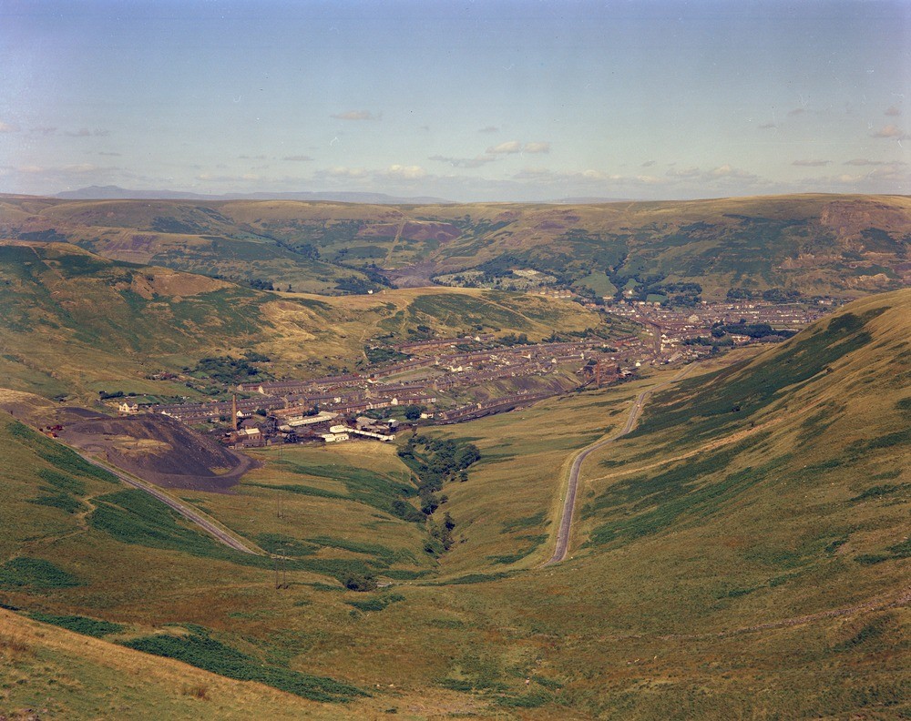
| Caption: | View from Bwlch-y-Clwydd along Cwmparc. Looking north-north-east, Glamorganshire. |
| Description: | View north-east from Bwlch-y-Clwydd along Cwmparc. A typical small coal mining village, Cwmparc, showing ribbon-development along the valley from its confluence at Treorchy (right middle distance) with the Rhondda Fawr. On the hillslopes lines of old coal-diggings can be seen, and several abandoned Pennant quarries are visible on the higher slopes. The middle skyline is that of the Pennant plateau, formed of thick Pennant Sandstone (Upper Coal Measures) and upwards of 2000 feet high. The Brecon Beacons form the distant skyline, formed of a great series of Lower Old Red Sandstone (Devonian) sandstones with a cap of Plateau Beds. The Pennant plateau is an undulating plateau, unbroken except for narrow deeply incised valleys that forms steep forbidding scarps. The rivers in the coalfields, cutting through the escarpment, follow courses that bear little relationship to the geological outcrops and have the appearance of being superimposed. |
| Date taken: | Sun Jan 01 00:00:00 GMT 1961 |
| Photographer: | Pulsford, J.M. |
| Copyright statement: | Crown |
| X longitude/easting: | 294500 |
| Y latitude/northing: | 194500 |
| Coordinate reference system, ESPG code: | 27700 (OSGB 1936 / British National Grid) |
| Orientation: | Landscape |
| Size: | 295.92 KB; 1000 x 792 pixels; 85 x 67 mm (print at 300 DPI); 265 x 210 mm (screen at 96 DPI); |
| Average Rating: | Not yet rated |
| Categories: | Unsorted Images |
Loading...
Loading...
Reviews
There is currently no feedback