| P number: | P209514 |
|---|---|
| Old photograph number: | A09593 |
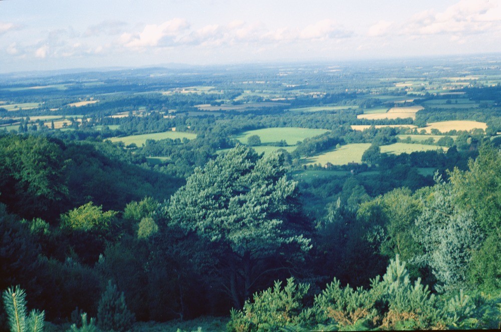
| Caption: | View of the Weald from the crest of Hythe Beds escarpment, Surrey. |
| Description: | View of the Weald from the crest of Hythe Beds escarpment, about 3/4 m. north of the summit of Blackdown. Looking south-south-east. Below this viewpoint, about 850 ft. above sea level, the ground drops steeply about 450 ft. to the Weald Clay lowland. In the distance to the right of the photo is the wooded Lower Greensand escarpment east of Petworth, and in the far distance lies the South Downs escarpment. The clump of trees on a prominent part of this escarpment is at Chanctonbury Ring. The Weald Clay consists of shales and mudstones with subordinate siltstones, sandstones, shelly limestones and clay ironstones. They are usually dark grey in colour but weather to a mottled yellow-brown. The Hythe Beds belong to the Lower Greensand and consist of alternating layers of hard, bluish-grey sandy limestones (rag) and grey loosely-cemented, calcareous, argillaceous sandstones speckled with glauconite (hassock). |
| Date taken: | Wed Jun 01 00:00:00 BST 1960 |
| Photographer: | Pulsford, J.M. |
| Copyright statement: | Crown |
| X longitude/easting: | 492500 |
| Y latitude/northing: | 130500 |
| Coordinate reference system, ESPG code: | 27700 (OSGB 1936 / British National Grid) |
| Orientation: | Landscape |
| Size: | 227.96 KB; 1000 x 664 pixels; 85 x 56 mm (print at 300 DPI); 265 x 176 mm (screen at 96 DPI); |
| Average Rating: | Not yet rated |
| Categories: | Unsorted Images, Geoscience subjects/ General views/ Clay, marl and shale country |
Loading...
Loading...
Reviews
There is currently no feedback