| P number: | P209395 |
|---|---|
| Old photograph number: | A09473 |
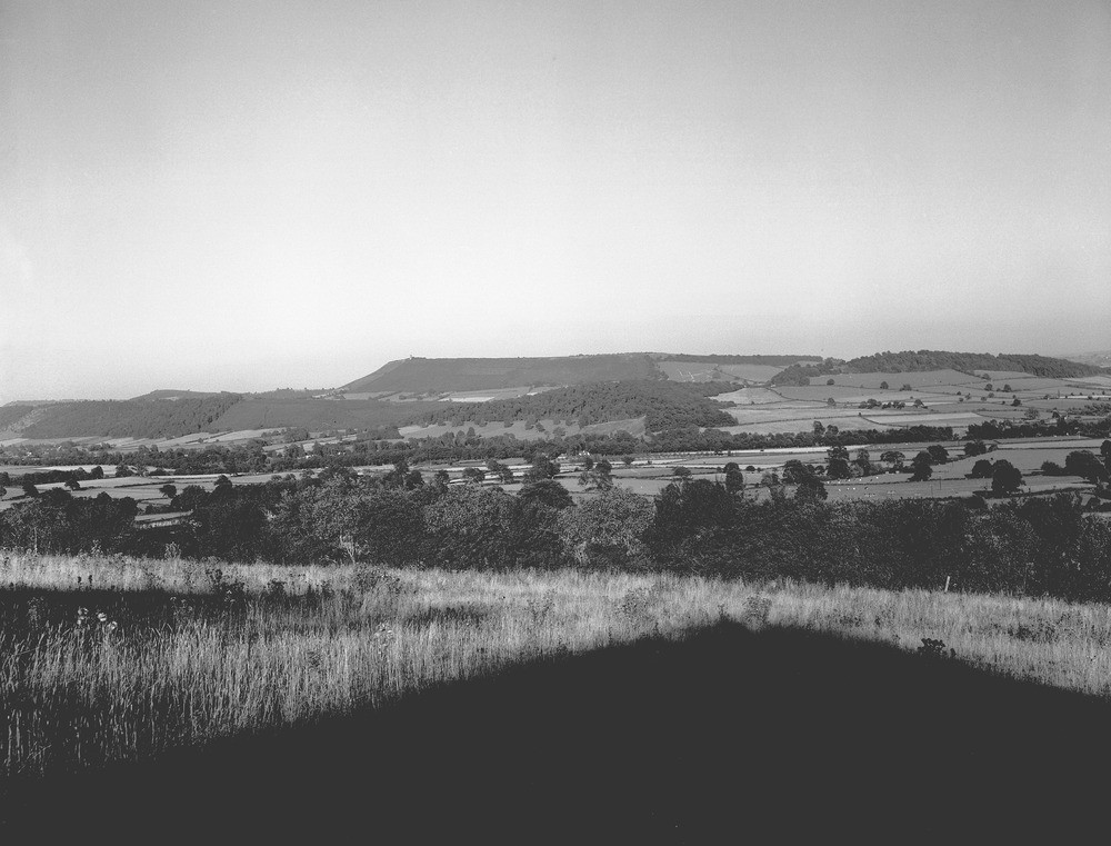
| Caption: | Callow Hill and Wenlock Edge from Long Lane, Shropshire. |
| Description: | Looking east 1050 yards north of Sibdon Carwood Church. Welsh Borderland scenery. The slope in the foreground is the dip-slope of the Horderley Sandstone (Caradocian). The low ground in the middle distance is occupied by Wenlock Shales, with a cover of boulder clay and the alluvium and terraces of the River Onny. The first and lower scarp on the left side of the photograph is Wenlock Edge, capped by the Wenlock Limestone. The second and higher scarp is Callow Hill, capped by the Aymestry Limestone. This hill is easily distinguished by the tower on its summit. Towards the right-hand side of the picture, both scarps are displaced by faulting. Ordovician and Silurian rocks form a succession of ridges and valleys south-east of and parallel to the eastern Uriconian range of Precambrian rocks. The lowest beds the Ordovician grits form the scarp of Hoar Edge. The Wenlock Limestone forms the Wenlock Edge,a ridge 16 miles long. The Aymestry Limestone forms a parallel but more dissected scarp along which the best known hills are Callow Hill, Norton Camp and View Edge. |
| Date taken: | Thu Jan 01 00:00:00 GMT 1959 |
| Photographer: | Pulsford, J.M. |
| Copyright statement: | Crown |
| X longitude/easting: | 341500 |
| Y latitude/northing: | 284500 |
| Coordinate reference system, ESPG code: | 27700 (OSGB 1936 / British National Grid) |
| Orientation: | Landscape |
| Size: | 185.33 KB; 1000 x 761 pixels; 85 x 64 mm (print at 300 DPI); 265 x 201 mm (screen at 96 DPI); |
| Average Rating: | Not yet rated |
| Categories: | Unsorted Images, Geoscience subjects/ Landforms, river/ Escarpments |
Loading...
Loading...
Reviews
There is currently no feedback