| P number: | P209393 |
|---|---|
| Old photograph number: | A09471 |
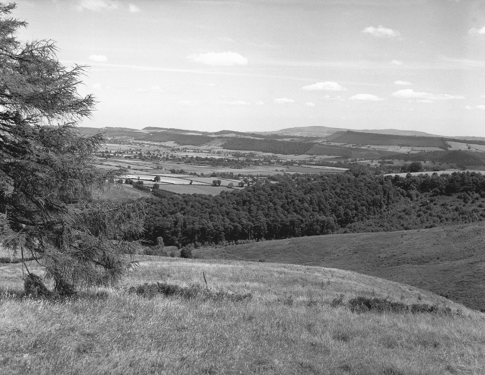
| Caption: | View from Wart Hill, Hopesay, Wenlock Edge. Looking east-north-east, Shropshire. |
| Description: | Uriconian and Longmyndian (Precambrian) rocks form the open land of the foreground. In the large wood and beyond is an area of Caradocian (Ordovician) sandstones and shales, which are succeeded in the vale beyond by Silurian, mainly Wenlock, shales, largely obscured by Boulder Clay and river alluvia. The wooded escarpments are capped by the Wenlock Limestone and, more distant, the Aymestry Limestone. In the latter case the limestone, or its stratigraphical equivalent does not in fact always outcrop at the top of the escarpment. Brown Clee Hill, with its two outliers of dolerite, and Carboniferous and Lower Old Red Sandstone sediments beneath, forms the distant skyline on the right. The general dip of all the Palaeozoic rocks is to the south-east. Since the early days of the history of geology as a science the Welsh Borderlands have attracted the attention of geologists due to the great variety and interest in the formations. It is a classic area for the study of the Palaeozoic as well as the older Precambrian rocks. |
| Date taken: | Thu Jan 01 00:00:00 GMT 1959 |
| Photographer: | Pulsford, J.M. |
| Copyright statement: | Crown |
| X longitude/easting: | 340500 |
| Y latitude/northing: | 284500 |
| Coordinate reference system, ESPG code: | 27700 (OSGB 1936 / British National Grid) |
| Orientation: | Landscape |
| Size: | 319.24 KB; 1000 x 775 pixels; 85 x 66 mm (print at 300 DPI); 265 x 205 mm (screen at 96 DPI); |
| Average Rating: | Not yet rated |
| Categories: | Unsorted Images, Geoscience subjects/ Landforms, river/ Escarpments |
Loading...
Loading...
Reviews
There is currently no feedback