| P number: | P000507 |
|---|---|
| Old photograph number: | C02557 |
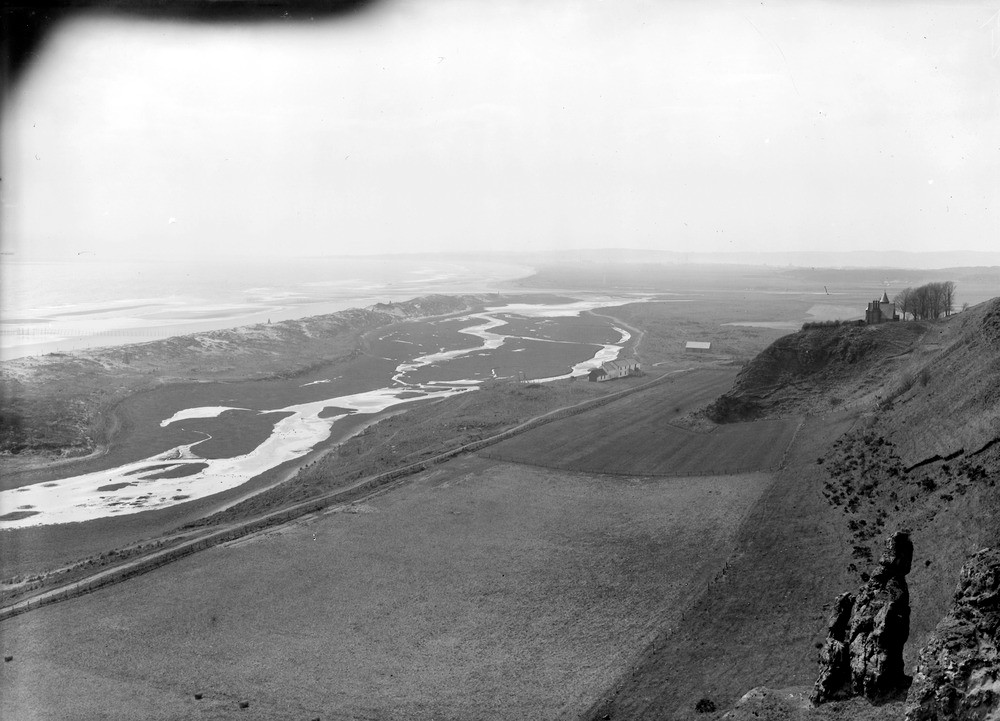
| Caption: | From near Kirkside, 5.6 km. north of Montrose. Looking south. The former course of the River North Esk is determined by the line of sand-dunes. |
| Description: | From near Kirkside, 5.6 km. north of Montrose. Looking south. The former course of the River North Esk is determined by the line of sand-dunes. The river now reaches the sea through a break in the sand-dunes about 1 mile south of its former mouth. The bluff to the right is the cliff of the 25 ft. raised beach with sea stack of Lower Old Red Sandstone now very much high and dry. |
| Date taken: | Thu Jan 01 00:00:00 GMT 1920 |
| Photographer: | Lunn, R. |
| Copyright statement: | Crown |
| Acknowledgment: | This image was digitized with grant-in-aid from SCRAN the Scottish Cultural Resources Access Network |
| X longitude/easting: | 374500 |
| Y latitude/northing: | 762500 |
| Coordinate reference system, ESPG code: | 27700 (OSGB 1936 / British National Grid) |
| Orientation: | Landscape |
| Size: | 164.64 KB; 1000 x 721 pixels; 85 x 61 mm (print at 300 DPI); 265 x 191 mm (screen at 96 DPI); |
| Average Rating: | Not yet rated |
| Categories: | Unsorted Images, Geoscience subjects/ Landforms, river/ Meanders |
Loading...
Loading...
Reviews
There is currently no feedback