| P number: | P000506 |
|---|---|
| Old photograph number: | C02556 |
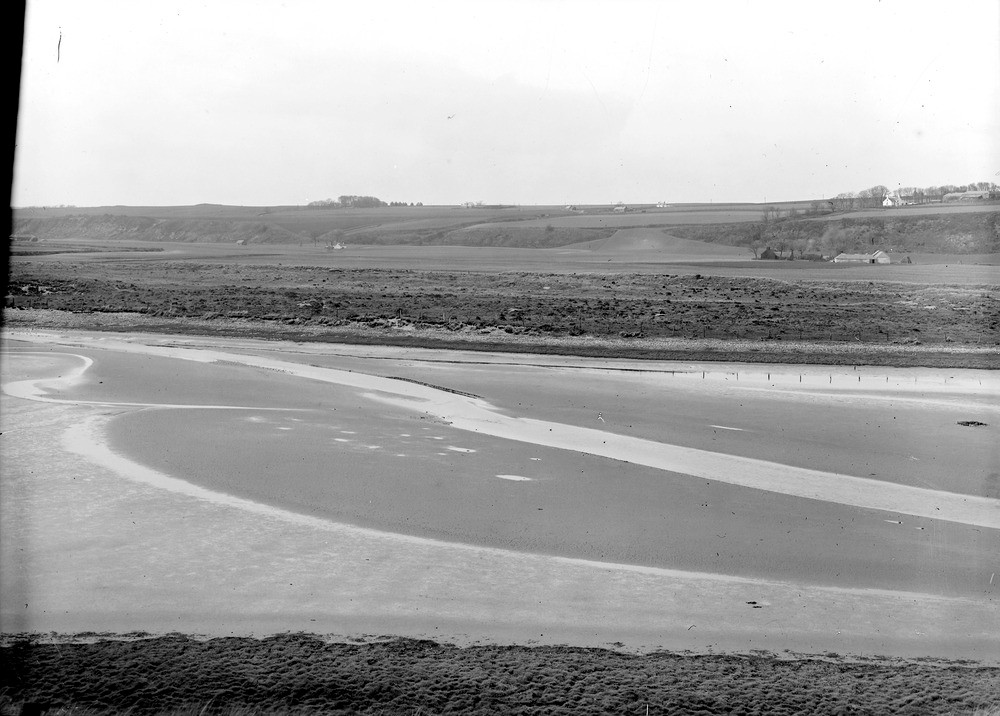
| Caption: | 4.8 km. north of Montrose. The former course of the River North Esk. The river now reaches the sea through a breach in the sand-hills about 1.6 m. south of its former mouth. Part of a panorama with C02555. |
| Description: | 4.8 km. north of Montrose. The former course of the River North Esk. The river now reaches the sea through a breach in the sand-hills about 1.6 m. south of its former mouth. Part of a panorama with C02555. In the middle distance is the 25 ft. raised beach and cliff. The cliff consists of basalts of Lower Old Red Sandstone age, and its direction is determined by a fault which brings the Lower Old Red Sandstone against the Upper Old Red Sandstone. |
| Date taken: | Wed Jan 01 00:00:00 GMT 1919 |
| Photographer: | Lunn, R. |
| Copyright statement: | Crown |
| Acknowledgment: | This image was digitized with grant-in-aid from SCRAN the Scottish Cultural Resources Access Network |
| X longitude/easting: | 373500 |
| Y latitude/northing: | 762500 |
| Coordinate reference system, ESPG code: | 27700 (OSGB 1936 / British National Grid) |
| Orientation: | Landscape |
| Size: | 166.39 KB; 1000 x 716 pixels; 85 x 61 mm (print at 300 DPI); 265 x 189 mm (screen at 96 DPI); |
| Average Rating: | Not yet rated |
| Categories: | Unsorted Images |
Loading...
Loading...
Reviews
There is currently no feedback