| P number: | P000504 |
|---|---|
| Old photograph number: | C02548 |
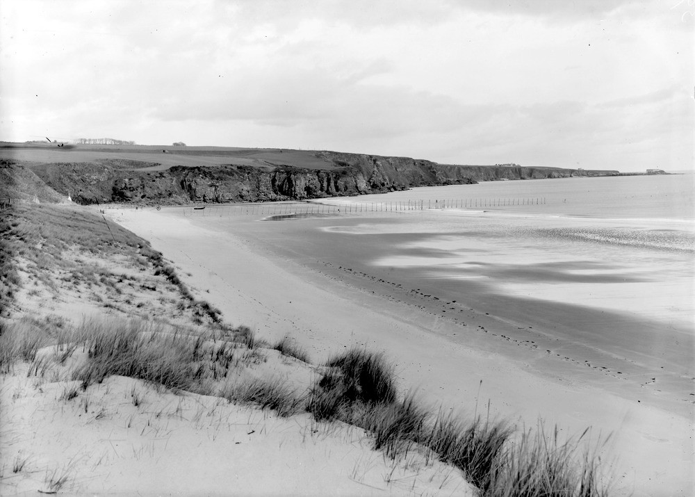
| Caption: | Boddin Point, the north horn of Lunan Bay, from 4 miles south-south-west of Montrose and 9.5 miles north-north-east of Arbroath. Looking north towards Boddin Point. |
| Description: | Boddin Point, the north horn of Lunan Bay, from 4 miles south-south-west of Montrose and 9.5 miles north-north-east of Arbroath. Looking north towards Boddin Point. Line of cliffs of Lower Old Red Sandstone volcanic rocks, determined by a fault bringing down Upper Old Red Sandstone beds with cornstone band (seen on the low headland of Boddin Point), and burnt for lime in the kiln seen right at the end of the headland. |
| Date taken: | Wed Jan 01 00:00:00 GMT 1919 |
| Photographer: | Lunn, R. |
| Copyright statement: | Crown |
| Acknowledgment: | This image was digitized with grant-in-aid from SCRAN the Scottish Cultural Resources Access Network |
| X longitude/easting: | 371500 |
| Y latitude/northing: | 753500 |
| Coordinate reference system, ESPG code: | 27700 (OSGB 1936 / British National Grid) |
| Orientation: | Landscape |
| Size: | 155.54 KB; 1000 x 715 pixels; 85 x 61 mm (print at 300 DPI); 265 x 189 mm (screen at 96 DPI); |
| Average Rating: | Not yet rated |
| Categories: | Unsorted Images |
Loading...
Loading...
Reviews
There is currently no feedback