| P number: | P000492 |
|---|---|
| Old photograph number: | C02092 |
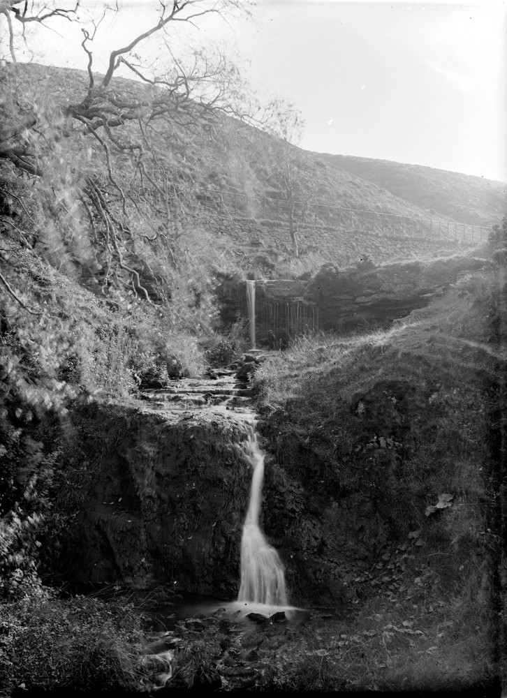
| Caption: | Burn flowing into Torduff Reservoir (at south end), and Pentland Hills. Midlothian. Local base of Upper Old Red Sandstone (at top of lower waterfall) resting upon Lower Old Red Sandstone acid lavas. |
| Description: | Burn flowing into Torduff Reservoir (at south end), and Pentland Hills. Midlothian. Local base of Upper Old Red Sandstone (at top of lower waterfall) resting upon Lower Old Red Sandstone acid lavas. The junction is unconformable, i.e. there was a significant break in the depositional sequence between the two units. The Upper Old Red Sandstone consists of mainly sandstones together with a few thin cornstones (caliche) which represent fossil soils in the then tropical climate. |
| Date taken: | Wed Jan 01 00:00:00 GMT 1913 |
| Photographer: | Lunn, R. |
| Copyright statement: | Crown |
| Acknowledgment: | This image was digitized with grant-in-aid from SCRAN the Scottish Cultural Resources Access Network |
| X longitude/easting: | 320500 |
| Y latitude/northing: | 667500 |
| Coordinate reference system, ESPG code: | 27700 (OSGB 1936 / British National Grid) |
| Orientation: | Portrait |
| Size: | 236.05 KB; 726 x 1000 pixels; 61 x 85 mm (print at 300 DPI); 192 x 265 mm (screen at 96 DPI); |
| Average Rating: | Not yet rated |
| Categories: | Unsorted Images |
Loading...
Loading...
Reviews
There is currently no feedback