| P number: | P000478 |
|---|---|
| Old photograph number: | C01919 |
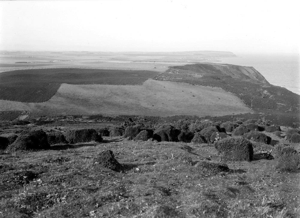
| Caption: | Looking north from the high ground above Port an Righ, 4.8 km. south-south-east of Hill of Fearn. Ross & Cromarty. Part of a panorama of the peninsula of Tarbat. (With C01918.) The sea cliffs on right determined by line of Great Glen Fault. |
| Description: | Looking north from the high ground above Port an Righ, 4.8 km. south-south-east of Hill of Fearn. Ross & Cromarty. Part of a panorama of the peninsula of Tarbat. (With C01918.) The sea cliffs on right determined by line of Great Glen Fault. The low flat ground is a succession of raised old sea-floors and beaches, the area being also largely covered with boulder clay. The hollow beyond hill (in middle distance) is an old sea-strait, and the rounded features of the hill are due to ice-movement across the Middle Old Red Sandstone and boulder clay. The Great Glen Fault Zone runs close to, and parallel with, the very straight coastline of this area. The zone itself initiated in the Caledonian period of tectonic activity and is now covered with Jurassic rocks. |
| Date taken: | Wed Jan 01 00:00:00 GMT 1913 |
| Photographer: | Lunn, R. |
| Copyright statement: | Crown |
| Acknowledgment: | This image was digitized with grant-in-aid from SCRAN the Scottish Cultural Resources Access Network |
| X longitude/easting: | 285500 |
| Y latitude/northing: | 873500 |
| Coordinate reference system, ESPG code: | 27700 (OSGB 1936 / British National Grid) |
| Orientation: | Landscape |
| Size: | 207.14 KB; 1000 x 729 pixels; 85 x 62 mm (print at 300 DPI); 265 x 193 mm (screen at 96 DPI); |
| Average Rating: | Not yet rated |
| Categories: | Unsorted Images |
Loading...
Loading...
Reviews
There is currently no feedback