| P number: | P000477 |
|---|---|
| Old photograph number: | C01918 |
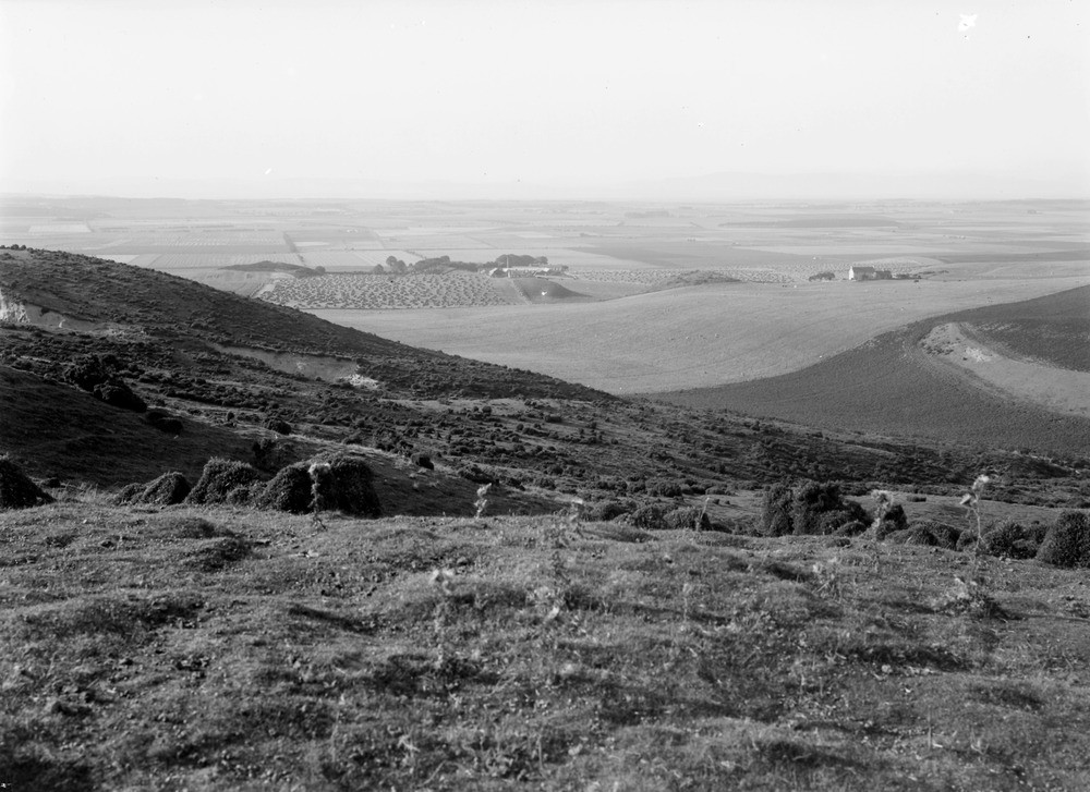
| Caption: | Looking north from the high ground above Port an Righ, 4.8 km. south-south-east of Hill of Fearn. Ross & Cromarty. Part of a panorama of the peninsula of Tarbat. (With C01919.) |
| Description: | Looking north from the high ground above Port an Righ, 4.8 km. south-south-east of Hill of Fearn. Ross & Cromarty. Part of a panorama of the peninsula of Tarbat. (With C01919.) The hollow in middle distance is an old sea-strait from a time when the sea level was much higher. The rounded features of the hill are due to ice-movement across the Middle Old Red Sandstone and deposition of boulder clay during the retreat of the glaciers in the last ice age. The Great Glen Fault Zone runs close to, and parallel with, the very straight coastline of this area. The zone itself initiated in the Caledonian period of tectonic activity is now covered with Jurassic rocks just off this coast. |
| Date taken: | Wed Jan 01 00:00:00 GMT 1913 |
| Photographer: | Lunn, R. |
| Copyright statement: | Crown |
| Acknowledgment: | This image was digitized with grant-in-aid from SCRAN the Scottish Cultural Resources Access Network |
| X longitude/easting: | 285500 |
| Y latitude/northing: | 873500 |
| Coordinate reference system, ESPG code: | 27700 (OSGB 1936 / British National Grid) |
| Orientation: | Landscape |
| Size: | 195.84 KB; 1000 x 727 pixels; 85 x 62 mm (print at 300 DPI); 265 x 192 mm (screen at 96 DPI); |
| Average Rating: | Not yet rated |
| Categories: | Unsorted Images |
Loading...
Loading...
Reviews
There is currently no feedback