| P number: | P000470 |
|---|---|
| Old photograph number: | C01881 |
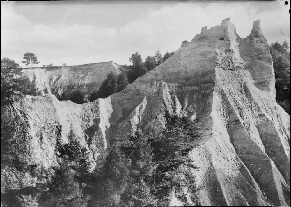
| Caption: | Fairy Glen, The Dens, 1.6 km. north of Fortrose, on the southern side of Rosemarkie Glen. Ross & Cromarty. |
| Description: | The protective remains of soil and vegetation on the pillars was once continuous with that seen in background, and serves as an index to the amount of material removed by denudation. The whole drift sequence, mostly till has been gullied by erosion. Photographed about 1910 before the present-day tree cover was established. Glacial sands overlying boulder clay filling old valley and now being eroded by the present Rosemarkie Burn and by the direct action of rain, giving rise to earth pillars. |
| Date taken: | Wed Jan 01 00:00:00 GMT 1913 |
| Photographer: | Lunn, R. |
| Copyright statement: | Crown |
| Acknowledgment: | This image was digitized with grant-in-aid from SCRAN the Scottish Cultural Resources Access Network |
| X longitude/easting: | 272500 |
| Y latitude/northing: | 858500 |
| Coordinate reference system, ESPG code: | 27700 (OSGB 1936 / British National Grid) |
| Orientation: | Landscape |
| Size: | 235.31 KB; 1000 x 711 pixels; 85 x 60 mm (print at 300 DPI); 265 x 188 mm (screen at 96 DPI); |
| Average Rating: | Not yet rated |
| Categories: | Unsorted Images, Geoscience subjects/ Landforms, glaciation/ Glacial deposits, boulder clay, sand, gravel, Geoscience subjects/ Landforms, weathering/ Earth pillars |
Loading...
Loading...
Reviews
There is currently no feedback