| P number: | P000461 |
|---|---|
| Old photograph number: | C01872 |
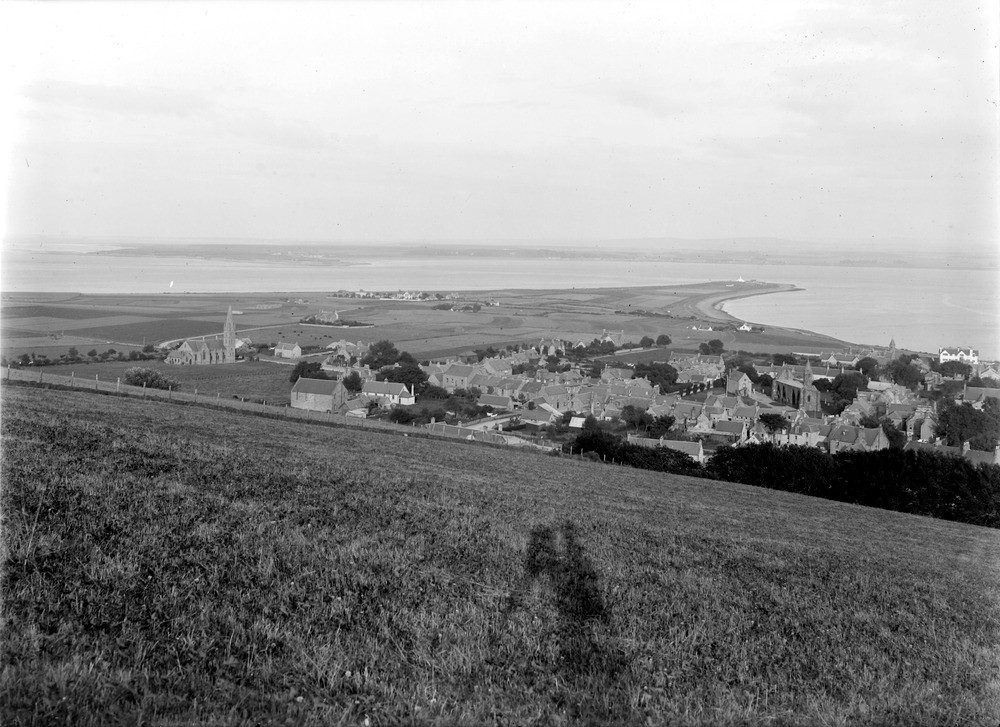
| Caption: | Looking east from the high ground above Fortrose. Ross & Cromarty. The photograph shows the cuspate foreland of Chanonry and entrance to the Inverness Firth with Fortrose in the foreground. |
| Description: | Looking east from the high ground above Fortrose. Ross & Cromarty. The photograph shows the cuspate foreland of Chanonry and entrance to the Inverness Firth with Fortrose in the foreground. Fortrose is built on the 100 ft. raised beach of which the much denuded south side is seen. The houses beyond stand on the 25 ft. raised beach and the 15 ft. beach forms the point. A spit with dunes of sand and shingle is currently forming at the point. |
| Date taken: | Wed Jan 01 00:00:00 GMT 1913 |
| Photographer: | Lunn, R. |
| Copyright statement: | Crown |
| Acknowledgment: | This image was digitized with grant-in-aid from SCRAN the Scottish Cultural Resources Access Network |
| X longitude/easting: | 272500 |
| Y latitude/northing: | 856500 |
| Coordinate reference system, ESPG code: | 27700 (OSGB 1936 / British National Grid) |
| Orientation: | Landscape |
| Size: | 205.38 KB; 1000 x 727 pixels; 85 x 62 mm (print at 300 DPI); 265 x 192 mm (screen at 96 DPI); |
| Average Rating: | Not yet rated |
| Categories: | Unsorted Images, Geoscience subjects/ Landforms, marine/ Raised beaches, Geoscience subjects/ Landforms, marine/ Coastal deposition, sand-bars, shingle-ridges, storm-beaches |
Loading...
Loading...
Reviews
There is currently no feedback