| P number: | P000460 |
|---|---|
| Old photograph number: | C01871 |
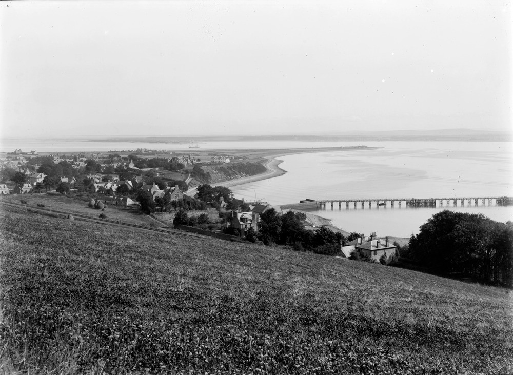
| Caption: | Looking east from the high ground above Fortrose. Ross & Cromarty. |
| Description: | The town, harbour and pier of Fortrose are clearly seen in the photograph. Great Glen Fracture Zone runs parallel with the shoreline then cuts across the Chanonry foreland. The Great Glen Fracture Zone is the most important north-east - south-west trending fault in a group that initiated in the Caledonian period of tectonic activity. The zone once established has been reactivated during subsequent periods of earth movement; and is still active today. Cuspate foreland of Chanonry and entrance to the Inverness Firth. Fortrose is built on the 100 ft. raised beach of which the much denuded south side is seen. The houses beyond stand on the 25 ft. raised beach and the 15 ft. beach forms the point. |
| Date taken: | Wed Jan 01 00:00:00 GMT 1913 |
| Photographer: | Lunn, R. |
| Copyright statement: | Crown |
| Acknowledgment: | This image was digitized with grant-in-aid from SCRAN the Scottish Cultural Resources Access Network |
| X longitude/easting: | 272500 |
| Y latitude/northing: | 856500 |
| Coordinate reference system, ESPG code: | 27700 (OSGB 1936 / British National Grid) |
| Orientation: | Landscape |
| Size: | 209.41 KB; 1000 x 731 pixels; 85 x 62 mm (print at 300 DPI); 265 x 193 mm (screen at 96 DPI); |
| Average Rating: | Not yet rated |
| Categories: | Unsorted Images, Geoscience subjects/ Landforms, marine/ Raised beaches, Geoscience subjects/ Landforms, marine/ Coastal deposition, sand-bars, shingle-ridges, storm-beaches |
Loading...
Loading...
Reviews
There is currently no feedback