| P number: | P000457 |
|---|---|
| Old photograph number: | C01776 |
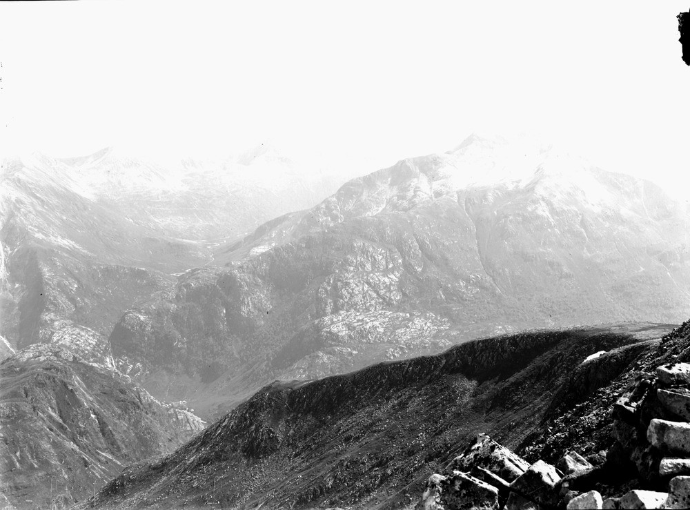
| Caption: | Mamore Forest looking south from the shoulder of Ben Nevis. Inverness-shire. |
| Description: | From left to right, An Garbhanach, Am Bodach and Sgurr a' Mhaim. The rocks in this area are heavily folded and inverted. On Sgurr a' Mhaim the older Glencoe Quartzites rest on top of the younger Leven Schists. Glen Nevis is in the foreground. Forms part of a panorama with C01774 and C0175. This complex area of ancient rocks is part of the West Grampian Complex, itself just one part of the Grampian Highlands which represent an area of metamorphic and igneous rocks, part of the eroded root zone of the Caledonian mountain belt which developed in late Precambrian to early Paleozoic times. An ancient high plateau surface that is now deeply dissected by preglacial fluvial erosion, glacial deepening and current post-glacial fluvial erosion is indicated by the overall similarity of heights of the remaining mountain tops. |
| Date taken: | Sat Jan 01 00:00:00 GMT 1910 |
| Photographer: | Lunn, R. |
| Copyright statement: | Crown |
| Acknowledgment: | This image was digitized with grant-in-aid from SCRAN the Scottish Cultural Resources Access Network |
| X longitude/easting: | 216500 |
| Y latitude/northing: | 771500 |
| Coordinate reference system, ESPG code: | 27700 (OSGB 1936 / British National Grid) |
| Orientation: | Landscape |
| Size: | 183.11 KB; 1000 x 739 pixels; 85 x 63 mm (print at 300 DPI); 265 x 196 mm (screen at 96 DPI); |
| Average Rating: | Not yet rated |
| Categories: | Unsorted Images |
Loading...
Loading...
Reviews
There is currently no feedback