| P number: | P000448 |
|---|---|
| Old photograph number: | C01765 |
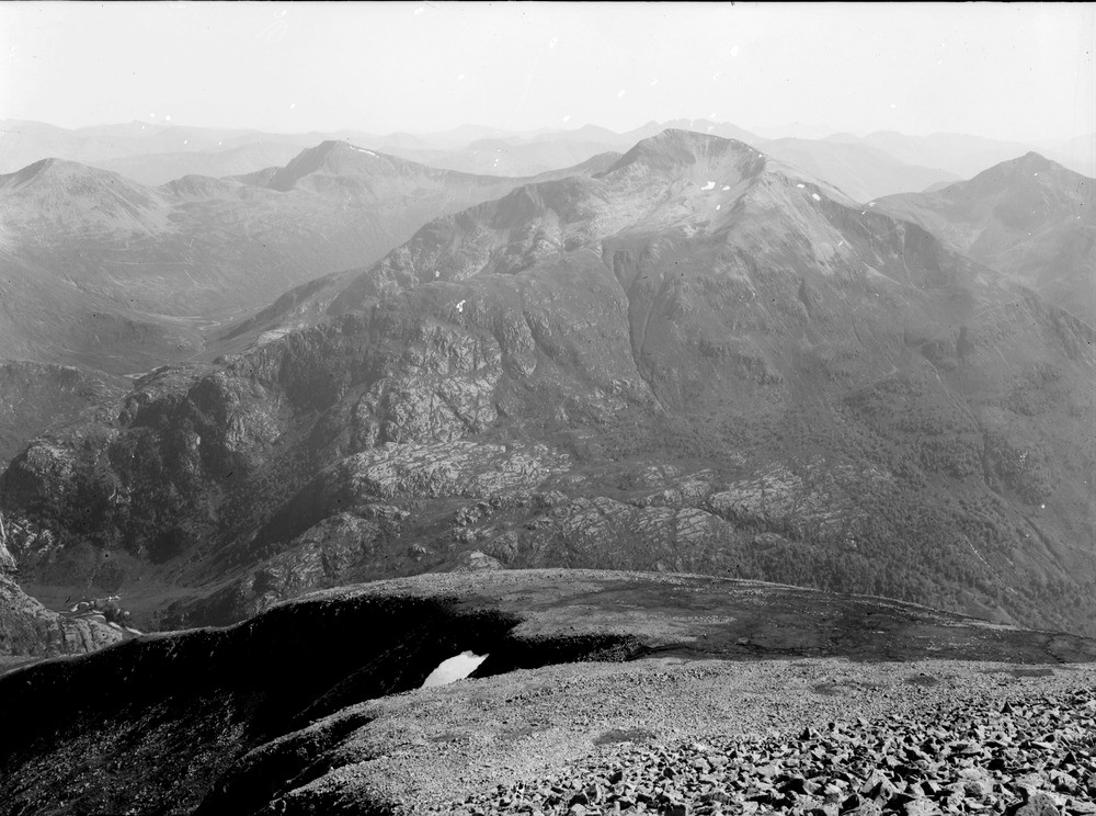
| Caption: | Mamore Forest looking east-south-east from the shoulder of Ben Nevis. Inverness-shire. |
| Description: | The former plateau, an area of comparatively flat ground has been deeply dissected mainly by the series of glaciations during the Quaternary era but also by fluvial (river) action between the glaciations and after. Forms part of a panorama with C01764. A dissected plateau. Mountains of interfolded Glencoe Quartzite and Leven Schists. From left to right, Binnein Beag, Binnein Mor, Na Gruagaichean and An Garbhanach above the steeply decending burn on the right. |
| Date taken: | Sat Jan 01 00:00:00 GMT 1910 |
| Photographer: | Lunn, R. |
| Copyright statement: | Crown |
| Acknowledgment: | This image was digitized with grant-in-aid from SCRAN the Scottish Cultural Resources Access Network |
| X longitude/easting: | 216500 |
| Y latitude/northing: | 771500 |
| Coordinate reference system, ESPG code: | 27700 (OSGB 1936 / British National Grid) |
| Orientation: | Landscape |
| Size: | 215.98 KB; 1000 x 744 pixels; 85 x 63 mm (print at 300 DPI); 265 x 197 mm (screen at 96 DPI); |
| Average Rating: | Not yet rated |
| Categories: | Unsorted Images, Geoscience subjects/ Landforms, weathering/ Plateaux, Geoscience subjects/ General views/ Metamorphic rock country |
Loading...
Loading...
Reviews
There is currently no feedback