| P number: | P202916 |
|---|---|
| Old photograph number: | A02968 |
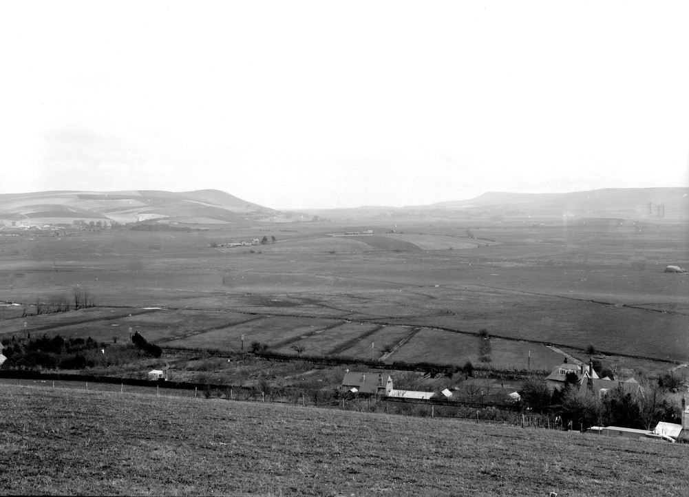
| Caption: | From Kingston Down, W. of Lewes. Looking E. |
| Description: | From Kingston Down, W. of Lewes. Looking E. The Brooks. The middle distance is occupied by the alluvial plain of The Brooks, out of which stand the partly-buried Lower Chalk hills known as Upper and Lower Rise, seen respectively in the middle and near the right-hand side of the view. In the background, to the left, is Mt. Caburn. Firle Beacon is farther away, to the right. Swanborough Farm at foot of slope in foreground. |
| Date taken: | Wed Apr 01 00:00:00 GMT 1925 |
| Photographer: | Rhodes, J. |
| Copyright statement: | Crown |
| X longitude/easting: | 539500 |
| Y latitude/northing: | 108500 |
| Coordinate reference system, ESPG code: | 27700 (OSGB 1936 / British National Grid) |
| Orientation: | Landscape |
| Size: | 168.96 KB; 1001 x 722 pixels; 85 x 61 mm (print at 300 DPI); 265 x 191 mm (screen at 96 DPI); |
| Average Rating: | Not yet rated |
| Categories: | Unsorted Images, Geoscience subjects/ Landforms, river/ Flood-plains and alluvial flats |
Loading...
Loading...
Reviews
There is currently no feedback