| P number: | P202908 |
|---|---|
| Old photograph number: | A02960 |
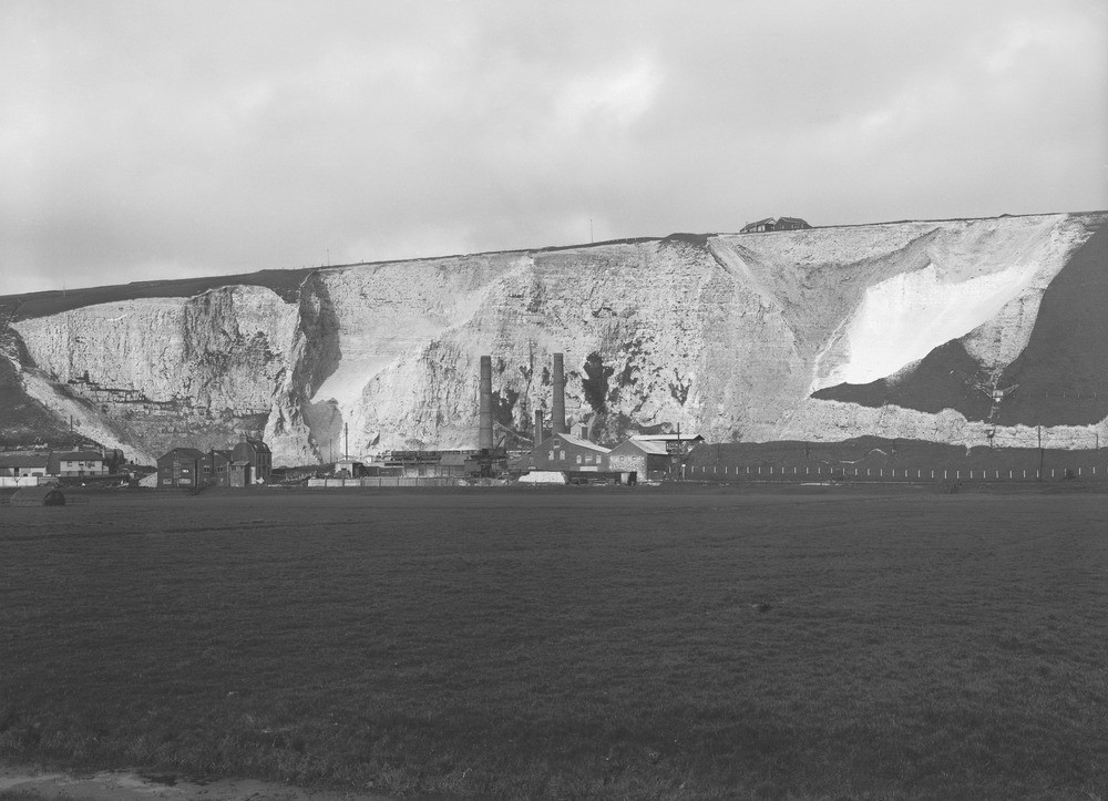
| Caption: | Lewes Cement and Lime Works Quarry at Cliffe, Lewes. Looking E. |
| Description: | Lewes Cement and Lime Works Quarry at Cliffe, Lewes. Looking E. The Snowdrop (or Navigation) Pit. Quarry in the bluff on the left bank of the River Ouse, exposing parts of the Zones of Micraster coranguinum and Micraster cortestudinarium. The zonal junction is approximately indicated by the tops of the two taller chimney-shafts at the cement works. The bedding dips at a low-angle to south-south-east, decreasing towards right of view. The Golf House near the upper edge of the quarry is about 200 ft. above the alluvial flat in the foreground. The River Ouse (not seen) crosses the field of view on the hither side of the buildings and row of white fence-posts. |
| Date taken: | Wed Apr 01 00:00:00 GMT 1925 |
| Photographer: | Rhodes, J. |
| Copyright statement: | Crown |
| X longitude/easting: | 542500 |
| Y latitude/northing: | 109500 |
| Coordinate reference system, ESPG code: | 27700 (OSGB 1936 / British National Grid) |
| Orientation: | Landscape |
| Size: | 192.40 KB; 1000 x 723 pixels; 85 x 61 mm (print at 300 DPI); 265 x 191 mm (screen at 96 DPI); |
| Average Rating: | Not yet rated |
| Categories: | Unsorted Images, Geoscience subjects/ Economic geology/ Cement and lime, limestone quarries and chalk pits |
Loading...
Loading...
Reviews
There is currently no feedback