| P number: | P202907 |
|---|---|
| Old photograph number: | A02959 |
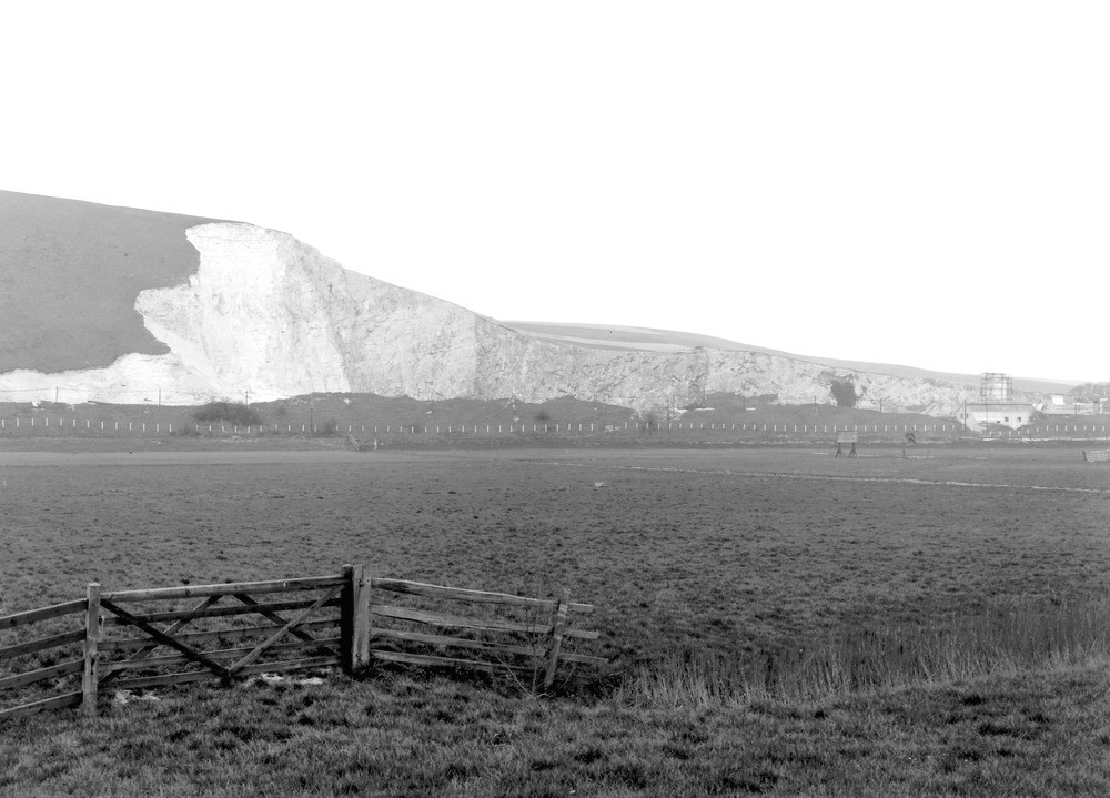
| Caption: | Lewes Cement and Lime Works. Quarry, Southerham. Looking NE. |
| Description: | Lewes Cement and Lime Works. Quarry, Southerham. Looking NE. Southerham Pit. Quarry in the river-bluff on left bank of River Ouse, south-east, of Lewes. The river (invisible) crosses the field of view on the hither side of the row of white fence-posts. Alluvial plain of The Brooks in the foreground. The quarry is in Middle and Upper Chalk; the junction being marked approximately by the lower edge of the dark square of ivy towards the right of section. Thereabouts the bedding dips 20 degrees NNW, but becomes horizontal at the left-hand limit of the view, which about coincides with the axial place of the Mt. Caburn syncline. |
| Date taken: | Wed Apr 01 00:00:00 GMT 1925 |
| Photographer: | Rhodes, J. |
| Copyright statement: | Crown |
| X longitude/easting: | 542500 |
| Y latitude/northing: | 109500 |
| Coordinate reference system, ESPG code: | 27700 (OSGB 1936 / British National Grid) |
| Orientation: | Landscape |
| Size: | 166.08 KB; 1000 x 719 pixels; 85 x 61 mm (print at 300 DPI); 265 x 190 mm (screen at 96 DPI); |
| Average Rating: | Not yet rated |
| Categories: | Unsorted Images, Geoscience subjects/ Economic geology/ Cement and lime, limestone quarries and chalk pits |
Loading...
Loading...
Reviews
There is currently no feedback