| P number: | P000440 |
|---|---|
| Old photograph number: | C01745 |
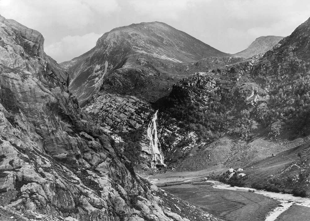
| Caption: | An Steall, Glen Nevis. Inverness-shire. The waterfall 'An Steall' of the 'hanging valley' of Allt Coire a' Mhail is seen in the centre. An Garbhanach of the Mamore Forest is the peak. |
| Description: | An Steall, Glen Nevis. Inverness-shire. The waterfall 'An Steall' of the 'hanging valley' of Allt Coire a' Mhail is seen in the centre. An Garbhanach of the Mamore Forest is the peak. The rock-slope on the left shows a water-worn surface of hornfelsed mica-schists, (Leven Schists) with pot-holes ('giant kettles') due to glacial stream cascading down marginal crevasse between ice and rock while the gorge was still filled with the Glen Nevis glacier. A hanging valley occurs when the main valley is over-deepened in relation to the tributary valley. In this case, the over-deepening is caused by a glacier that occupied the Glen Nevis valley. It is usual to have rapids or a waterfall where the hanging valley enters the main valley. |
| Date taken: | Sat Jan 01 00:00:00 GMT 1910 |
| Photographer: | Lunn, R. |
| Copyright statement: | Crown |
| Acknowledgment: | This image was digitized with grant-in-aid from SCRAN the Scottish Cultural Resources Access Network |
| X longitude/easting: | 218500 |
| Y latitude/northing: | 768500 |
| Coordinate reference system, ESPG code: | 27700 (OSGB 1936 / British National Grid) |
| Orientation: | Landscape |
| Size: | 302.48 KB; 1000 x 715 pixels; 85 x 61 mm (print at 300 DPI); 265 x 189 mm (screen at 96 DPI); |
| Average Rating: | Not yet rated |
| Categories: | Best of BGS Images/ Images from the archives, Geoscience subjects/ Landforms, glaciation/ Hanging valleys and gorges |
Loading...
Loading...
Reviews
There is currently no feedback