| P number: | P000430 |
|---|---|
| Old photograph number: | C01542 |
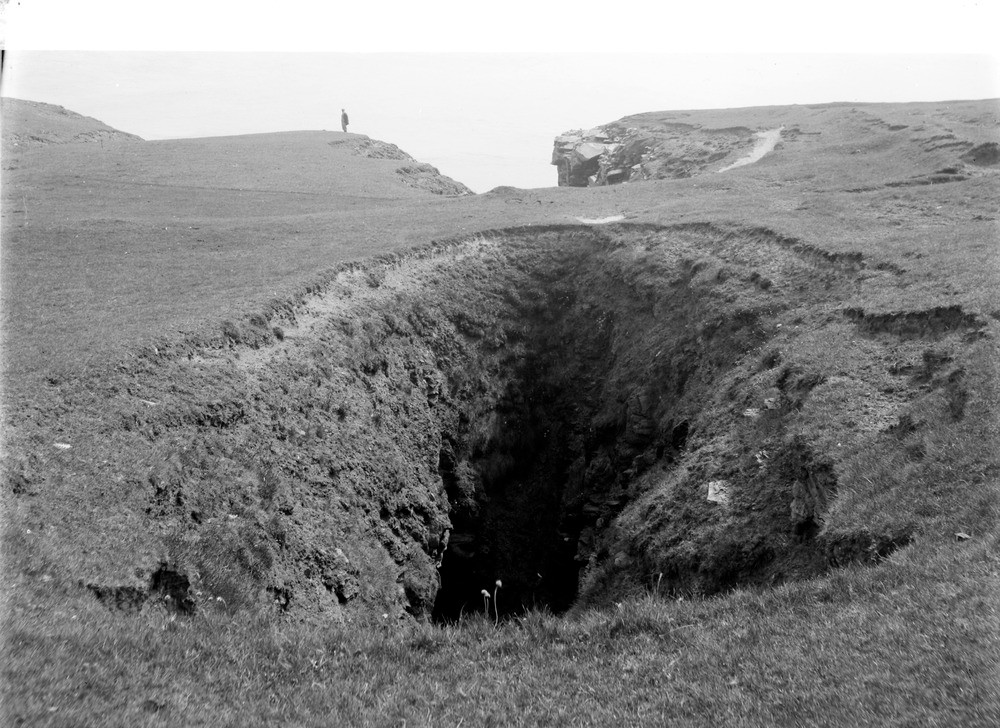
| Caption: | The Devil's Bridge, Holborn Head. Caithness. A 'blow-hole' or 'gloup' is developed in the well-jointed Old Red Sandstone flagstones. A close-up of the bridge of land over the cave. Looking seawards. |
| Description: | The Devil's Bridge, Holborn Head. Caithness. A 'blow-hole' or 'gloup' is developed in the well-jointed Old Red Sandstone flagstones. A close-up of the bridge of land over the cave. Looking seawards. Marine erosion and subsidence along joints in flagstone giving rise to 'blow-hole' or 'gloup'. A man stands on the cliff edge for scale. |
| Date taken: | Sat Jan 01 00:00:00 GMT 1910 |
| Photographer: | Lunn, R. |
| Copyright statement: | Crown |
| Acknowledgment: | This image was digitized with grant-in-aid from SCRAN the Scottish Cultural Resources Access Network |
| X longitude/easting: | 310500 |
| Y latitude/northing: | 971500 |
| Coordinate reference system, ESPG code: | 27700 (OSGB 1936 / British National Grid) |
| Orientation: | Landscape |
| Size: | 242.42 KB; 1000 x 728 pixels; 85 x 62 mm (print at 300 DPI); 265 x 193 mm (screen at 96 DPI); |
| Average Rating: | Not yet rated |
| Categories: | Best of BGS Images/ Images from the archives, Geoscience subjects/ Landforms, marine/ Caves, blowholes, inlets |
Loading...
Loading...
Reviews
There is currently no feedback