| P number: | P000423 |
|---|---|
| Old photograph number: | C01522 |
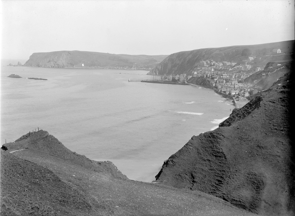
| Caption: | Gamrie Bay, 10.5 km. east of Banff. A view of the whole bay with Gardenstown in the centre, Crovie just visible in the distance. Taken from near More Head looking north-east. |
| Description: | Gamrie Bay, 10.5 km. east of Banff. A view of the whole bay with Gardenstown in the centre, Crovie just visible in the distance. Taken from near More Head looking north-east. Bay cut out of Middle Old Red Sandstone beds (the softer and less resistant rock); the headlands on each side, the harder and more resistant rocks, are formed of greywackes and shales of the Macduff Slate Formation, Southern Highland Group of the Dalradian Supergroup. (Previously known as the Highland Metamorphic Series.) Gardenstown, a fishing village was founded in 1720 by Alexander Garden Esq. of Troup. |
| Date taken: | Sat Jan 01 00:00:00 GMT 1910 |
| Photographer: | Lunn, R. |
| Copyright statement: | Crown |
| Acknowledgment: | This image was digitized with grant-in-aid from SCRAN the Scottish Cultural Resources Access Network |
| X longitude/easting: | 379500 |
| Y latitude/northing: | 864500 |
| Coordinate reference system, ESPG code: | 27700 (OSGB 1936 / British National Grid) |
| Orientation: | Landscape |
| Size: | 173.56 KB; 1000 x 731 pixels; 85 x 62 mm (print at 300 DPI); 265 x 193 mm (screen at 96 DPI); |
| Average Rating: | Not yet rated |
| Categories: | Unsorted Images, Geoscience subjects/ Landforms, marine/ Influence of structure, composition, faults, joints and dip, Geoscience subjects/ Landforms, marine/ Coastal scenery, general views, Geoscience subjects/ Landforms, marine/ Headlands and islands |
Loading...
Loading...
Reviews
There is currently no feedback