| P number: | P202694 |
|---|---|
| Old photograph number: | A02746 |
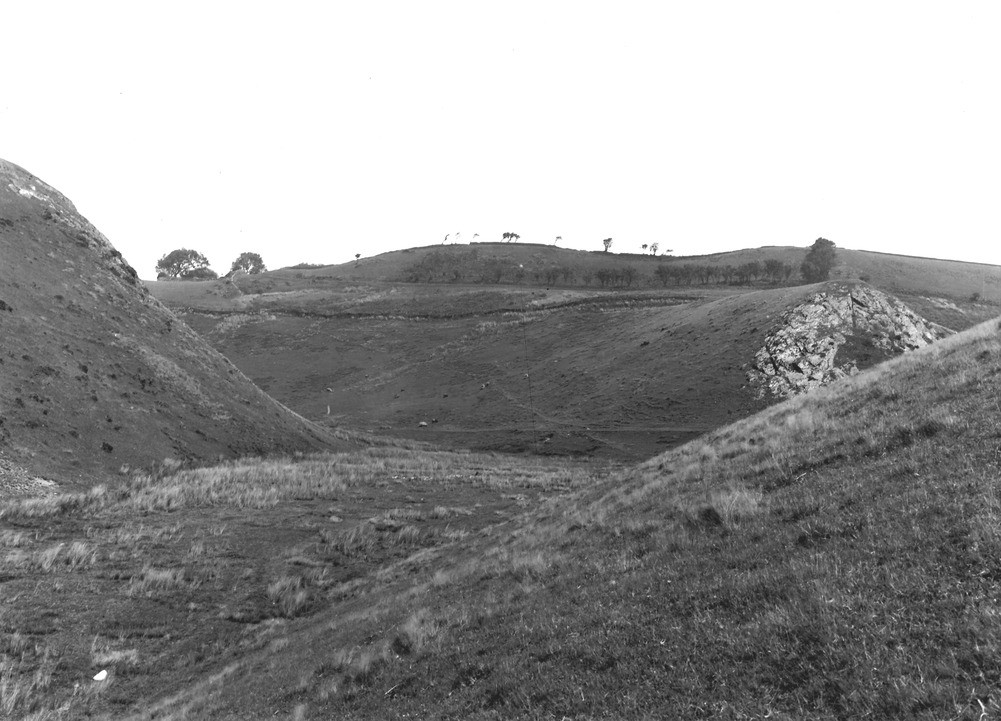
| Caption: | 500 yd. and 10 degrees E. of S. from High Cockhow, about 1 m. S. of Ennerdale Bridge. Looking N. |
| Description: | 500 yd. and 10 degrees E. of S. from High Cockhow, about 1 m. S. of Ennerdale Bridge. Looking N. The junction of the 700 ft. (-) overflow channel from glacial Lake Ennerdale and one somewhat above 600 ft. The former enters the deep gorge, now occupied by Nannycatch Beck, from the NE. and the latter from the NW. The characteristic wide flat-bottomed nature of the typical 'overflow' is well shown here. The background is 'Irish Sea' Glacial gravels on Skiddaw Slate. The spur in the middle right indicates the pre-overflow surface. |
| Date taken: | Tue Jul 01 00:00:00 BST 1924 |
| Photographer: | Rhodes, J. |
| Copyright statement: | Crown |
| X longitude/easting: | 306500 |
| Y latitude/northing: | 514500 |
| Coordinate reference system, ESPG code: | 27700 (OSGB 1936 / British National Grid) |
| Orientation: | Landscape |
| Size: | 189.63 KB; 1001 x 721 pixels; 85 x 61 mm (print at 300 DPI); 265 x 191 mm (screen at 96 DPI); |
| Average Rating: | Not yet rated |
| Categories: | Unsorted Images, Geoscience subjects/ Landforms, glaciation/ Glacial lakes and rock basins, Geoscience subjects/ Landforms, glaciation/ Overflow and marginal channels |
Loading...
Loading...
Reviews
There is currently no feedback