| P number: | P202689 |
|---|---|
| Old photograph number: | A02741 |
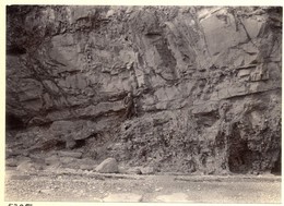
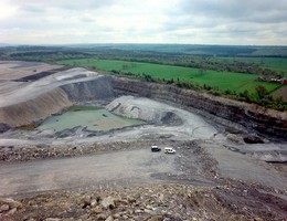
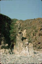
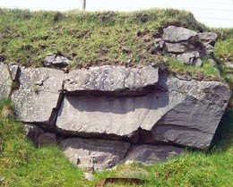
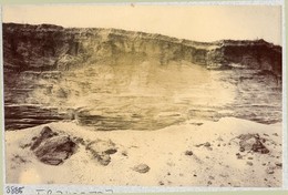
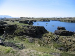
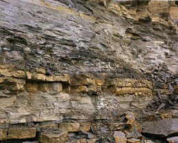
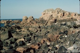
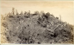
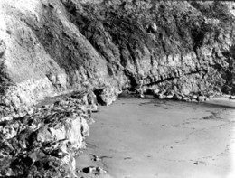
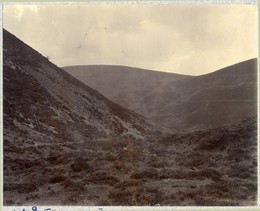
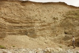
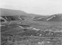
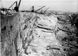
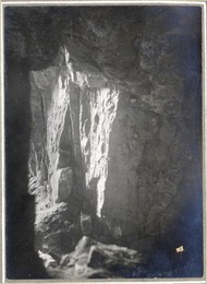
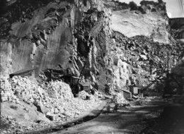
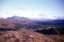
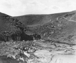
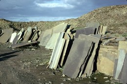
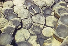
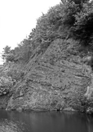
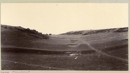
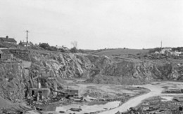
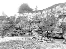
| Caption: | Quarry, Ogbourne Maizey, about 1 1/2 m. N. of Marlborough. Looking SE. |
| Description: | Quarry, Ogbourne Maizey, about 1 1/2 m. N. of Marlborough. Looking SE. Chalk Rock Beds, Ogbourne Maizey. Nodular chalk with hard yellow bands and green nodules. The lower limit of the Chalk Rock group is about a foot below the hammer. The upper limit is just above the pit-edge on the right. A marl-seam about 2 feet above the hammer marks the junction of the Zones of Terebratulina lata and Holaster planus. |
| Date taken: | Thu May 01 00:00:00 BST 1924 |
| Photographer: | Rhodes, J. |
| Copyright statement: | Crown |
| X longitude/easting: | 418500 |
| Y latitude/northing: | 171500 |
| Coordinate reference system, ESPG code: | 27700 (OSGB 1936 / British National Grid) |
| Orientation: | Landscape |
| Size: | 430.82 KB; 1001 x 734 pixels; 85 x 62 mm (print at 300 DPI); 265 x 194 mm (screen at 96 DPI); |
| Average Rating: | Not yet rated |
| Categories: | Unsorted Images |
Loading...
Loading...
Reviews
There is currently no feedback