| P number: | P202667 |
|---|---|
| Old photograph number: | A02719 |
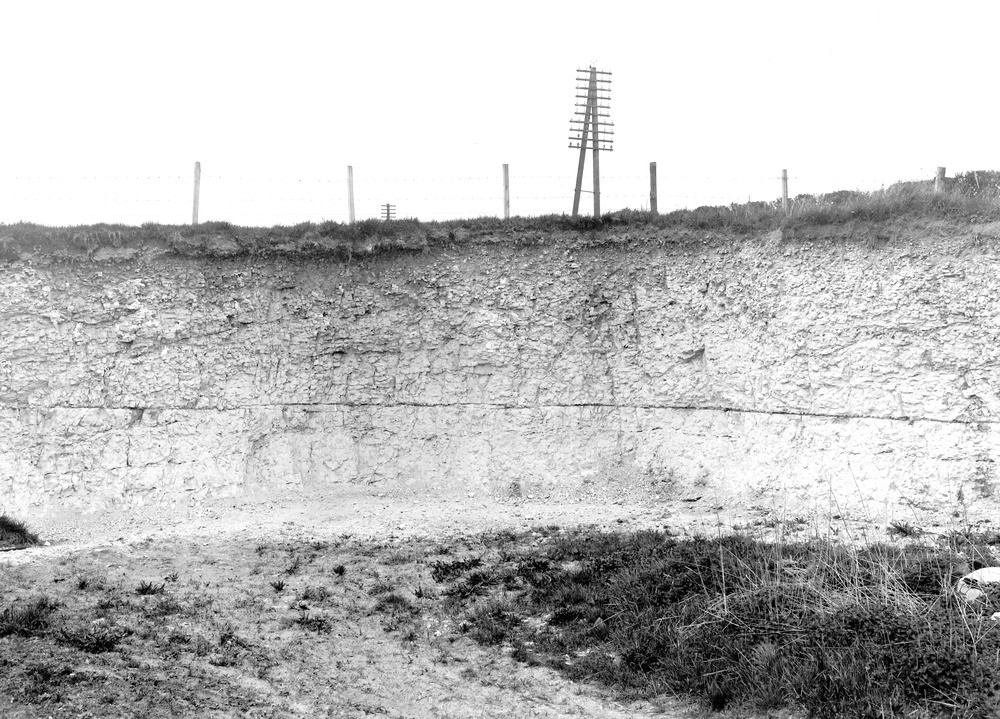
| Caption: | Pit, about 1/8 m. W. of Fyfield. Looking WNW. |
| Description: | Pit, about 1/8 m. W. of Fyfield. Looking WNW. Chalk-pit near Fyfield. Nodular chalk in the upper part of the Zone of Holaster planus. A continuous seam of tabular flint, approximately parallel with the bedding, runs through the section. |
| Date taken: | Thu May 01 00:00:00 BST 1924 |
| Photographer: | Rhodes, J. |
| Copyright statement: | Crown |
| X longitude/easting: | 414500 |
| Y latitude/northing: | 168500 |
| Coordinate reference system, ESPG code: | 27700 (OSGB 1936 / British National Grid) |
| Orientation: | Landscape |
| Size: | 295.99 KB; 1000 x 719 pixels; 85 x 61 mm (print at 300 DPI); 265 x 190 mm (screen at 96 DPI); |
| Average Rating: | Not yet rated |
| Categories: | Unsorted Images, Geoscience subjects/ Economic geology/ Cement and lime, limestone quarries and chalk pits |
Loading...
Loading...
Reviews
There is currently no feedback