| P number: | P202643 |
|---|---|
| Old photograph number: | A02695 |
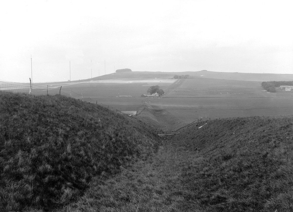
| Caption: | From Roughsidge Hill, about 1 1/2 m. NE of Bishop's Cannings. Looking NW. |
| Description: | From Roughsidge Hill, about 1 1/2 m. NE of Bishop's Cannings. Looking NW. Wansdyke, near Shepherd's Shore. Saxon ditch with ram or vallum on its south (left) side. It is here seen crossing the line of the high road from Devizes to Swindon at the farm-buildings of Shepherd's Shore ('shore' - cutting), in the middle of the view, and ascending Morgan's Hill in the distance. |
| Date taken: | Thu May 01 00:00:00 BST 1924 |
| Photographer: | Rhodes, J. |
| Copyright statement: | Crown |
| X longitude/easting: | 405500 |
| Y latitude/northing: | 165500 |
| Coordinate reference system, ESPG code: | 27700 (OSGB 1936 / British National Grid) |
| Orientation: | Landscape |
| Size: | 186.48 KB; 1001 x 724 pixels; 85 x 61 mm (print at 300 DPI); 265 x 192 mm (screen at 96 DPI); |
| Average Rating: | Not yet rated |
| Categories: | Unsorted Images, Geoscience subjects/ Archaeology and early history |
Loading...
Loading...
Reviews
There is currently no feedback