| P number: | P202576 |
|---|---|
| Old photograph number: | A02628 |
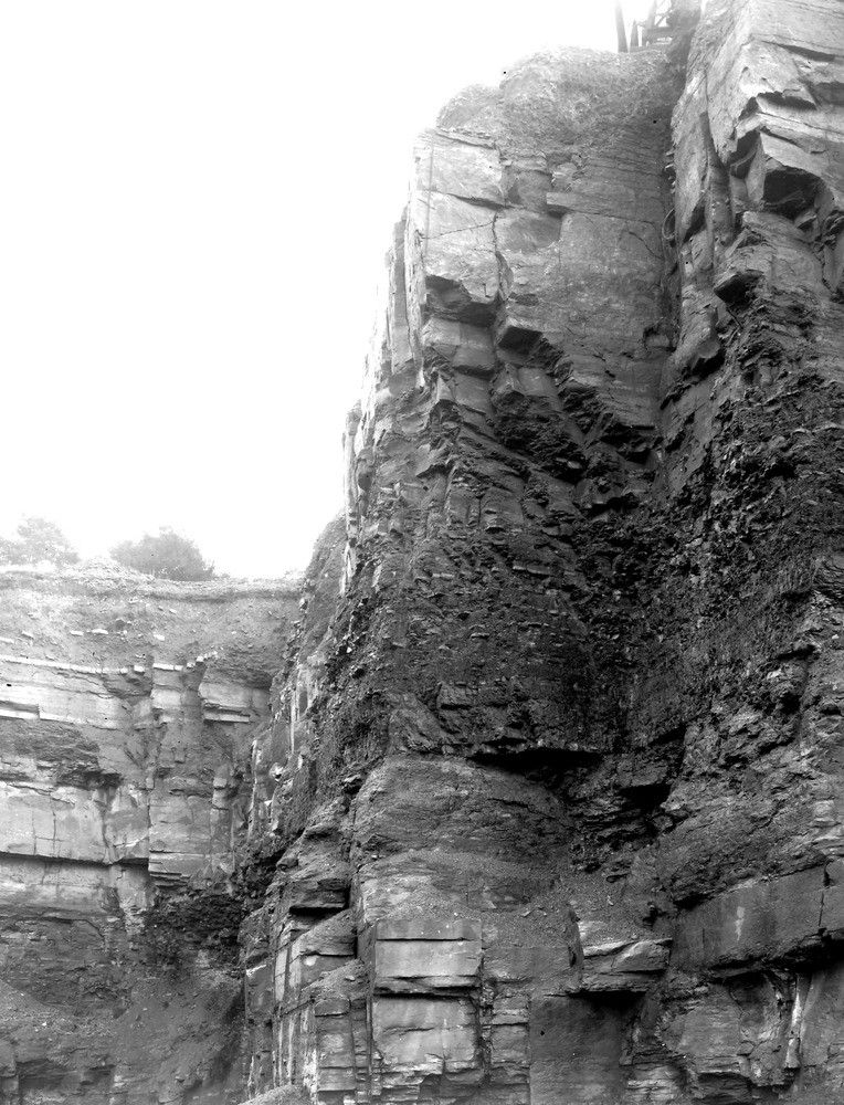
| Caption: | Whitegate Quarry, Padeham Road, Burnley. Looking E. |
| Description: | Whitegate Quarry, Padeham Road, Burnley. Looking E. Middle Coal Measures. Low Bottom Mine and Tim Bobbin Rock. Section: Soil. Top foreground: Evenly bedded sandstone, 12 ft. 0 in. Mudstone with ironstone bands, 6 ft. 0 in. Coal, Low Bottom Mine, 3 ft. 9 in. Fireclay, 6 ft. 0 in. Massive sandstone. Tim Bobbin Rock,10 ft. 0 in. seen. |
| Date taken: | Sat Sep 01 00:00:00 BST 1923 |
| Photographer: | Rhodes, J. |
| Copyright statement: | Crown |
| X longitude/easting: | 383500 |
| Y latitude/northing: | 433500 |
| Coordinate reference system, ESPG code: | 27700 (OSGB 1936 / British National Grid) |
| Orientation: | Portrait |
| Size: | 264.74 KB; 764 x 1000 pixels; 65 x 85 mm (print at 300 DPI); 202 x 265 mm (screen at 96 DPI); |
| Average Rating: | Not yet rated |
| Categories: | Unsorted Images, Geoscience subjects/ Economic geology/ Coal |
Loading...
Loading...
Reviews
There is currently no feedback