| P number: | P202567 |
|---|---|
| Old photograph number: | A02619 |
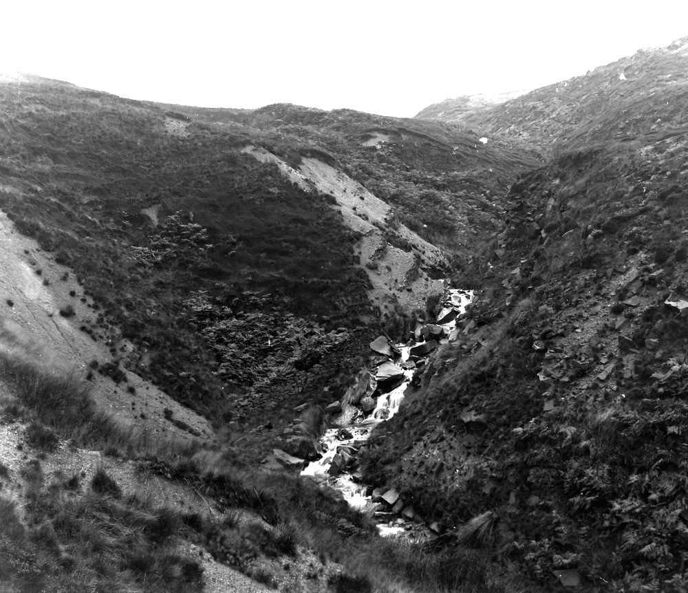
| Caption: | Naden Brook, 1/4 m. from W. end of Upper Reservoir. Looking NW. |
| Description: | Naden Brook, 1/4 m. from W. end of Upper Reservoir. Looking NW. Millstone Grit. The stream flows along the line of the Naden Valley Fault. On the right (downthrow) side Rough Rock features and blocks are seen. The scars in the middle distance on the left side of the stream are Lower Haslingden Flags, dipping steeply south. |
| Date taken: | Sat Sep 01 00:00:00 BST 1923 |
| Photographer: | Rhodes, J. |
| Copyright statement: | Crown |
| X longitude/easting: | 385500 |
| Y latitude/northing: | 413500 |
| Coordinate reference system, ESPG code: | 27700 (OSGB 1936 / British National Grid) |
| Orientation: | Landscape |
| Size: | 293.40 KB; 1000 x 862 pixels; 85 x 73 mm (print at 300 DPI); 265 x 228 mm (screen at 96 DPI); |
| Average Rating: | Not yet rated |
| Categories: | Unsorted Images, Geoscience subjects/ Landforms, river/ Valleys, Geoscience subjects/ Landforms, river/ Valleys controlled by faults and shatter belts |
Loading...
Loading...
Reviews
There is currently no feedback